You are here: Home > Network List > CU - Caribbean Network (USGS) Stations List
> Station BBGH Gun Hill, Barbados > Earthquake Result Viewer
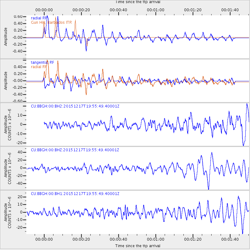
BBGH Gun Hill, Barbados - Earthquake Result Viewer
*The percent match for this event was below the threshold and hence no stack was calculated.
| Earthquake location: |
Near Coast Of Chiapas, Mexico |
| Earthquake latitude/longitude: |
15.9/-93.4 |
| Earthquake time(UTC): |
2015/12/17 (351) 19:49:54 GMT |
| Earthquake Depth: |
97 km |
| Earthquake Magnitude: |
6.4 MWB, 6.6 MI |
| Earthquake Catalog/Contributor: |
NEIC PDE/NEIC COMCAT |
|
| Network: |
CU Caribbean Network (USGS) |
| Station: |
BBGH Gun Hill, Barbados |
| Lat/Lon: |
13.14 N/59.56 W |
| Elevation: |
180 m |
|
| Distance: |
32.9 deg |
| Az: |
90.283 deg |
| Baz: |
278.961 deg |
| Ray Param: |
$rayparam |
*The percent match for this event was below the threshold and hence was not used in the summary stack. |
|
| Radial Match: |
77.279526 % |
| Radial Bump: |
375 |
| Transverse Match: |
75.87039 % |
| Transverse Bump: |
400 |
| SOD ConfigId: |
1259291 |
| Insert Time: |
2015-12-31 20:12:15.551 +0000 |
| GWidth: |
2.5 |
| Max Bumps: |
400 |
| Tol: |
0.001 |
|
Signal To Noise
| Channel | StoN | STA | LTA |
| CU:BBGH:00:BHZ:20151217T19:55:49.40001Z | 2.0846565 | 4.7273543E-6 | 2.2676898E-6 |
| CU:BBGH:00:BH1:20151217T19:55:49.40001Z | 1.4636731 | 2.9684975E-6 | 2.028115E-6 |
| CU:BBGH:00:BH2:20151217T19:55:49.40001Z | 1.6032124 | 3.4070124E-6 | 2.125116E-6 |
| Arrivals |
| Ps | |
| PpPs | |
| PsPs/PpSs | |


