You are here: Home > Network List > CN - Canadian National Seismograph Network Stations List
> Station INK INUVIK, NT > Earthquake Result Viewer
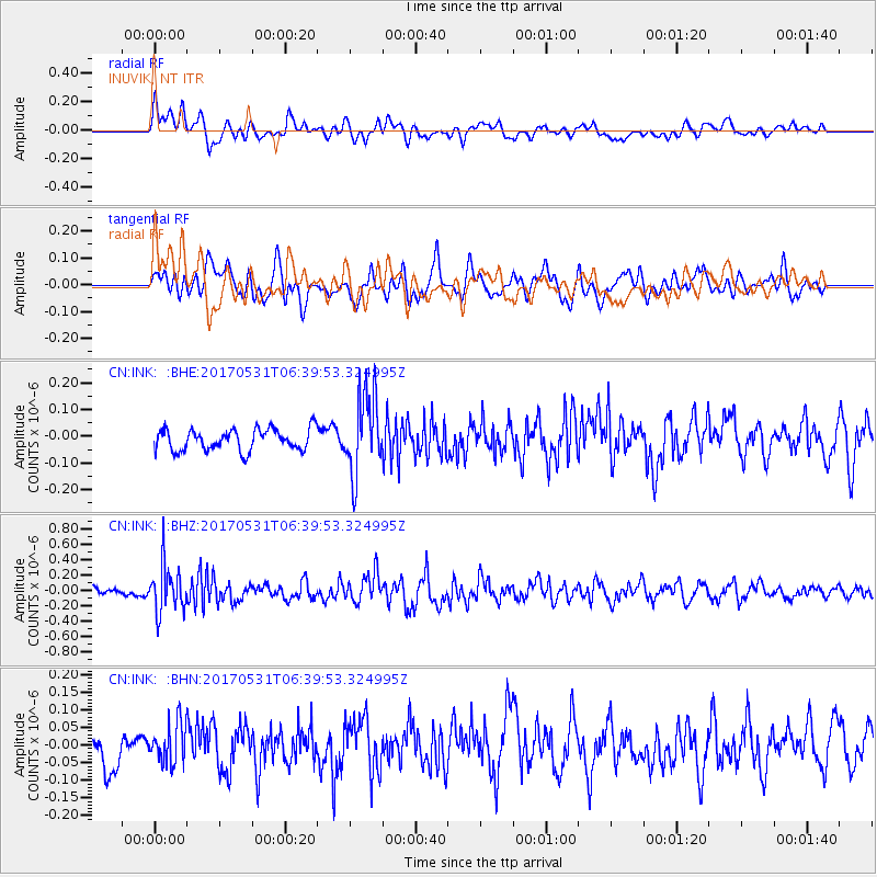
INK INUVIK, NT - Earthquake Result Viewer
*The percent match for this event was below the threshold and hence no stack was calculated.
| Earthquake location: |
Mariana Islands |
| Earthquake latitude/longitude: |
19.1/145.9 |
| Earthquake time(UTC): |
2017/05/31 (151) 06:29:32 GMT |
| Earthquake Depth: |
121 km |
| Earthquake Magnitude: |
5.4 Mww |
| Earthquake Catalog/Contributor: |
NEIC PDE/us |
|
| Network: |
CN Canadian National Seismograph Network |
| Station: |
INK INUVIK, NT |
| Lat/Lon: |
68.31 N/133.53 W |
| Elevation: |
44 m |
|
| Distance: |
68.9 deg |
| Az: |
23.144 deg |
| Baz: |
268.638 deg |
| Ray Param: |
$rayparam |
*The percent match for this event was below the threshold and hence was not used in the summary stack. |
|
| Radial Match: |
56.223007 % |
| Radial Bump: |
400 |
| Transverse Match: |
56.46683 % |
| Transverse Bump: |
400 |
| SOD ConfigId: |
13570011 |
| Insert Time: |
2019-04-28 02:57:58.757 +0000 |
| GWidth: |
2.5 |
| Max Bumps: |
400 |
| Tol: |
0.001 |
|
Signal To Noise
| Channel | StoN | STA | LTA |
| CN:INK: :BHZ:20170531T06:39:53.324995Z | 4.4011474 | 2.9518975E-7 | 6.707109E-8 |
| CN:INK: :BHN:20170531T06:39:53.324995Z | 0.98279923 | 5.8097573E-8 | 5.9114384E-8 |
| CN:INK: :BHE:20170531T06:39:53.324995Z | 3.7709274 | 1.4981562E-7 | 3.972912E-8 |
| Arrivals |
| Ps | |
| PpPs | |
| PsPs/PpSs | |


