You are here: Home > Network List > G - GEOSCOPE Stations List
> Station FDF Fort de France, Martinique France > Earthquake Result Viewer
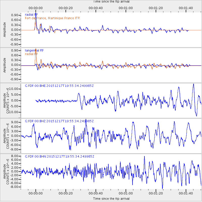
FDF Fort de France, Martinique France - Earthquake Result Viewer
*The percent match for this event was below the threshold and hence no stack was calculated.
| Earthquake location: |
Near Coast Of Chiapas, Mexico |
| Earthquake latitude/longitude: |
15.9/-93.4 |
| Earthquake time(UTC): |
2015/12/17 (351) 19:49:54 GMT |
| Earthquake Depth: |
97 km |
| Earthquake Magnitude: |
6.4 MWB, 6.6 MI |
| Earthquake Catalog/Contributor: |
NEIC PDE/NEIC COMCAT |
|
| Network: |
G GEOSCOPE |
| Station: |
FDF Fort de France, Martinique France |
| Lat/Lon: |
14.73 N/61.14 W |
| Elevation: |
467 m |
|
| Distance: |
31.1 deg |
| Az: |
87.713 deg |
| Baz: |
276.402 deg |
| Ray Param: |
$rayparam |
*The percent match for this event was below the threshold and hence was not used in the summary stack. |
|
| Radial Match: |
78.59372 % |
| Radial Bump: |
398 |
| Transverse Match: |
71.765724 % |
| Transverse Bump: |
400 |
| SOD ConfigId: |
1259291 |
| Insert Time: |
2015-12-31 20:12:47.402 +0000 |
| GWidth: |
2.5 |
| Max Bumps: |
400 |
| Tol: |
0.001 |
|
Signal To Noise
| Channel | StoN | STA | LTA |
| G:FDF:00:BHZ:20151217T19:55:34.249985Z | 13.3876095 | 3.6415918E-6 | 2.7201207E-7 |
| G:FDF:00:BHN:20151217T19:55:34.249985Z | 2.5215824 | 1.3033501E-6 | 5.168779E-7 |
| G:FDF:00:BHE:20151217T19:55:34.249985Z | 8.265517 | 3.604487E-6 | 4.360873E-7 |
| Arrivals |
| Ps | |
| PpPs | |
| PsPs/PpSs | |


