You are here: Home > Network List > TA - USArray Transportable Network (new EarthScope stations) Stations List
> Station Y32A R-V Farms, Vernon, TX, USA > Earthquake Result Viewer
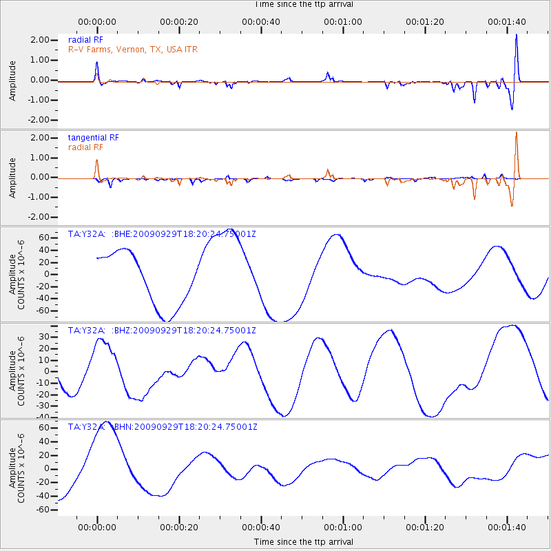
Y32A R-V Farms, Vernon, TX, USA - Earthquake Result Viewer
*The percent match for this event was below the threshold and hence no stack was calculated.
| Earthquake location: |
Samoa Islands Region |
| Earthquake latitude/longitude: |
-15.6/-172.0 |
| Earthquake time(UTC): |
2009/09/29 (272) 18:08:21 GMT |
| Earthquake Depth: |
10 km |
| Earthquake Magnitude: |
5.6 MB |
| Earthquake Catalog/Contributor: |
WHDF/NEIC |
|
| Network: |
TA USArray Transportable Network (new EarthScope stations) |
| Station: |
Y32A R-V Farms, Vernon, TX, USA |
| Lat/Lon: |
34.00 N/99.44 W |
| Elevation: |
412 m |
|
| Distance: |
84.8 deg |
| Az: |
52.744 deg |
| Baz: |
247.436 deg |
| Ray Param: |
$rayparam |
*The percent match for this event was below the threshold and hence was not used in the summary stack. |
|
| Radial Match: |
46.73883 % |
| Radial Bump: |
400 |
| Transverse Match: |
56.511192 % |
| Transverse Bump: |
285 |
| SOD ConfigId: |
2622 |
| Insert Time: |
2010-03-06 00:16:25.487 +0000 |
| GWidth: |
2.5 |
| Max Bumps: |
400 |
| Tol: |
0.001 |
|
Signal To Noise
| Channel | StoN | STA | LTA |
| TA:Y32A: :BHZ:20090929T18:20:24.75001Z | 2.3663497 | 2.7015514E-5 | 1.1416535E-5 |
| TA:Y32A: :BHN:20090929T18:20:24.75001Z | 3.268015 | 7.059525E-5 | 2.1601874E-5 |
| TA:Y32A: :BHE:20090929T18:20:24.75001Z | 1.8396174 | 7.903556E-5 | 4.2963045E-5 |
| Arrivals |
| Ps | |
| PpPs | |
| PsPs/PpSs | |


