You are here: Home > Network List > TA - USArray Transportable Network (new EarthScope stations) Stations List
> Station F21K Alatna River, AK, USA > Earthquake Result Viewer
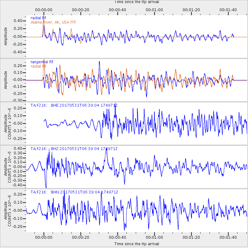
F21K Alatna River, AK, USA - Earthquake Result Viewer
*The percent match for this event was below the threshold and hence no stack was calculated.
| Earthquake location: |
Mariana Islands |
| Earthquake latitude/longitude: |
19.1/145.9 |
| Earthquake time(UTC): |
2017/05/31 (151) 06:29:32 GMT |
| Earthquake Depth: |
121 km |
| Earthquake Magnitude: |
5.4 Mww |
| Earthquake Catalog/Contributor: |
NEIC PDE/us |
|
| Network: |
TA USArray Transportable Network (new EarthScope stations) |
| Station: |
F21K Alatna River, AK, USA |
| Lat/Lon: |
67.22 N/153.48 W |
| Elevation: |
597 m |
|
| Distance: |
61.3 deg |
| Az: |
22.762 deg |
| Baz: |
249.994 deg |
| Ray Param: |
$rayparam |
*The percent match for this event was below the threshold and hence was not used in the summary stack. |
|
| Radial Match: |
64.45689 % |
| Radial Bump: |
400 |
| Transverse Match: |
56.071423 % |
| Transverse Bump: |
400 |
| SOD ConfigId: |
13570011 |
| Insert Time: |
2019-04-28 03:01:04.709 +0000 |
| GWidth: |
2.5 |
| Max Bumps: |
400 |
| Tol: |
0.001 |
|
Signal To Noise
| Channel | StoN | STA | LTA |
| TA:F21K: :BHZ:20170531T06:39:04.174971Z | 4.5909777 | 1.9957567E-7 | 4.347128E-8 |
| TA:F21K: :BHN:20170531T06:39:04.174971Z | 1.6360828 | 6.174882E-8 | 3.7741867E-8 |
| TA:F21K: :BHE:20170531T06:39:04.174971Z | 3.3753562 | 8.973408E-8 | 2.658507E-8 |
| Arrivals |
| Ps | |
| PpPs | |
| PsPs/PpSs | |


