You are here: Home > Network List > IU - Global Seismograph Network (GSN - IRIS/USGS) Stations List
> Station JOHN Johnston Island, USA > Earthquake Result Viewer
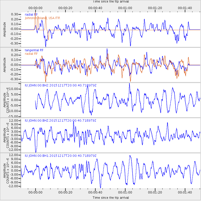
JOHN Johnston Island, USA - Earthquake Result Viewer
*The percent match for this event was below the threshold and hence no stack was calculated.
| Earthquake location: |
Near Coast Of Chiapas, Mexico |
| Earthquake latitude/longitude: |
15.9/-93.4 |
| Earthquake time(UTC): |
2015/12/17 (351) 19:49:54 GMT |
| Earthquake Depth: |
97 km |
| Earthquake Magnitude: |
6.4 MWB, 6.6 MI |
| Earthquake Catalog/Contributor: |
NEIC PDE/NEIC COMCAT |
|
| Network: |
IU Global Seismograph Network (GSN - IRIS/USGS) |
| Station: |
JOHN Johnston Island, USA |
| Lat/Lon: |
16.73 N/169.53 W |
| Elevation: |
2.0 m |
|
| Distance: |
72.6 deg |
| Az: |
282.881 deg |
| Baz: |
78.232 deg |
| Ray Param: |
$rayparam |
*The percent match for this event was below the threshold and hence was not used in the summary stack. |
|
| Radial Match: |
62.79213 % |
| Radial Bump: |
387 |
| Transverse Match: |
61.078026 % |
| Transverse Bump: |
400 |
| SOD ConfigId: |
1259291 |
| Insert Time: |
2015-12-31 20:17:53.572 +0000 |
| GWidth: |
2.5 |
| Max Bumps: |
400 |
| Tol: |
0.001 |
|
Signal To Noise
| Channel | StoN | STA | LTA |
| IU:JOHN:00:BHZ:20151217T20:00:40.718979Z | 3.2238498 | 6.6589673E-6 | 2.0655327E-6 |
| IU:JOHN:00:BH1:20151217T20:00:40.718979Z | 0.9192614 | 3.2578364E-6 | 3.5439716E-6 |
| IU:JOHN:00:BH2:20151217T20:00:40.718979Z | 1.3861899 | 6.552565E-6 | 4.7270323E-6 |
| Arrivals |
| Ps | |
| PpPs | |
| PsPs/PpSs | |


