You are here: Home > Network List > TA - USArray Transportable Network (new EarthScope stations) Stations List
> Station M31M Drury Creek, Yukon, CA > Earthquake Result Viewer
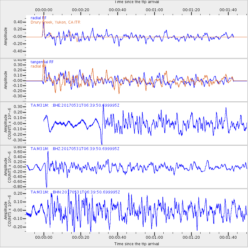
M31M Drury Creek, Yukon, CA - Earthquake Result Viewer
*The percent match for this event was below the threshold and hence no stack was calculated.
| Earthquake location: |
Mariana Islands |
| Earthquake latitude/longitude: |
19.1/145.9 |
| Earthquake time(UTC): |
2017/05/31 (151) 06:29:32 GMT |
| Earthquake Depth: |
121 km |
| Earthquake Magnitude: |
5.4 Mww |
| Earthquake Catalog/Contributor: |
NEIC PDE/us |
|
| Network: |
TA USArray Transportable Network (new EarthScope stations) |
| Station: |
M31M Drury Creek, Yukon, CA |
| Lat/Lon: |
62.20 N/134.39 W |
| Elevation: |
639 m |
|
| Distance: |
68.5 deg |
| Az: |
29.719 deg |
| Baz: |
270.239 deg |
| Ray Param: |
$rayparam |
*The percent match for this event was below the threshold and hence was not used in the summary stack. |
|
| Radial Match: |
67.71551 % |
| Radial Bump: |
400 |
| Transverse Match: |
71.010025 % |
| Transverse Bump: |
400 |
| SOD ConfigId: |
13570011 |
| Insert Time: |
2019-04-28 03:01:51.889 +0000 |
| GWidth: |
2.5 |
| Max Bumps: |
400 |
| Tol: |
0.001 |
|
Signal To Noise
| Channel | StoN | STA | LTA |
| TA:M31M: :BHZ:20170531T06:39:50.699995Z | 5.5153694 | 3.1197018E-7 | 5.6563785E-8 |
| TA:M31M: :BHN:20170531T06:39:50.699995Z | 2.5640903 | 1.0303749E-7 | 4.0184815E-8 |
| TA:M31M: :BHE:20170531T06:39:50.699995Z | 2.7006366 | 1.5554684E-7 | 5.7596367E-8 |
| Arrivals |
| Ps | |
| PpPs | |
| PsPs/PpSs | |


