You are here: Home > Network List > TA - USArray Transportable Network (new EarthScope stations) Stations List
> Station MDND Maddock, ND, USA > Earthquake Result Viewer
MDND Maddock, ND, USA - Earthquake Result Viewer
*The percent match for this event was below the threshold and hence no stack was calculated.
| Earthquake location: |
Mariana Islands |
| Earthquake latitude/longitude: |
19.1/145.9 |
| Earthquake time(UTC): |
2017/05/31 (151) 06:29:32 GMT |
| Earthquake Depth: |
121 km |
| Earthquake Magnitude: |
5.4 Mww |
| Earthquake Catalog/Contributor: |
NEIC PDE/us |
|
| Network: |
TA USArray Transportable Network (new EarthScope stations) |
| Station: |
MDND Maddock, ND, USA |
| Lat/Lon: |
47.85 N/99.60 W |
| Elevation: |
479 m |
|
| Distance: |
91.4 deg |
| Az: |
37.8 deg |
| Baz: |
300.631 deg |
| Ray Param: |
$rayparam |
*The percent match for this event was below the threshold and hence was not used in the summary stack. |
|
| Radial Match: |
56.798504 % |
| Radial Bump: |
400 |
| Transverse Match: |
56.186382 % |
| Transverse Bump: |
325 |
| SOD ConfigId: |
13570011 |
| Insert Time: |
2019-04-28 03:01:53.716 +0000 |
| GWidth: |
2.5 |
| Max Bumps: |
400 |
| Tol: |
0.001 |
|
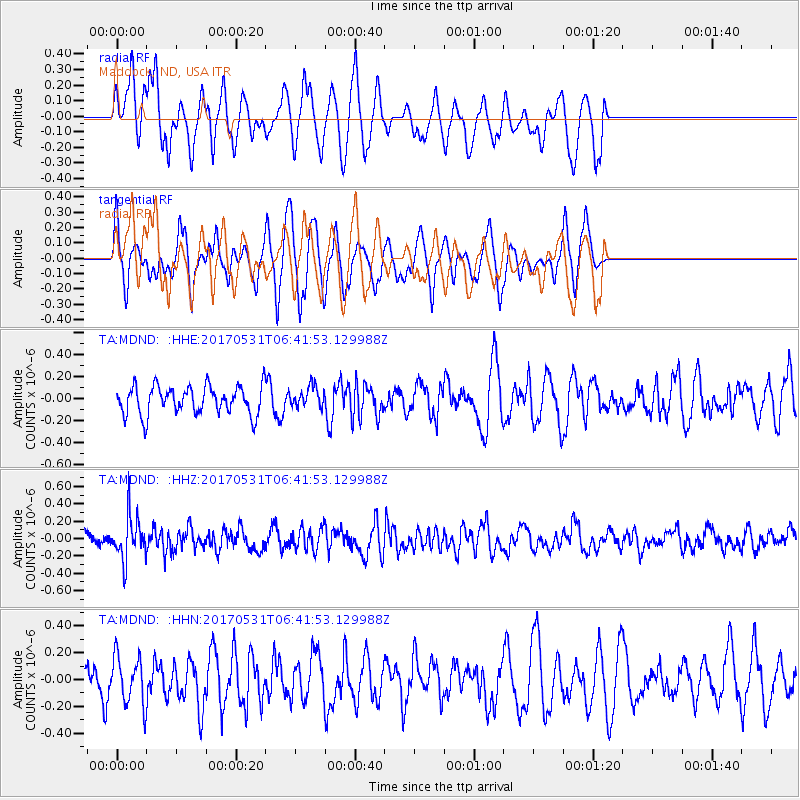
Signal To Noise
| Channel | StoN | STA | LTA |
| TA:MDND: :HHZ:20170531T06:41:53.129988Z | 2.5747287 | 2.5266255E-7 | 9.8131714E-8 |
| TA:MDND: :HHN:20170531T06:41:53.129988Z | 1.3194512 | 1.7583253E-7 | 1.3326188E-7 |
| TA:MDND: :HHE:20170531T06:41:53.129988Z | 0.741184 | 9.43349E-8 | 1.2727595E-7 |
| Arrivals |
| Ps | |
| PpPs | |
| PsPs/PpSs | |


