You are here: Home > Network List > TA - USArray Transportable Network (new EarthScope stations) Stations List
> Station P17K Kvichak River, AK, USA > Earthquake Result Viewer
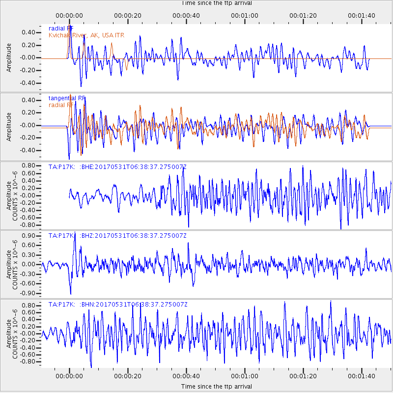
P17K Kvichak River, AK, USA - Earthquake Result Viewer
*The percent match for this event was below the threshold and hence no stack was calculated.
| Earthquake location: |
Mariana Islands |
| Earthquake latitude/longitude: |
19.1/145.9 |
| Earthquake time(UTC): |
2017/05/31 (151) 06:29:32 GMT |
| Earthquake Depth: |
121 km |
| Earthquake Magnitude: |
5.4 Mww |
| Earthquake Catalog/Contributor: |
NEIC PDE/us |
|
| Network: |
TA USArray Transportable Network (new EarthScope stations) |
| Station: |
P17K Kvichak River, AK, USA |
| Lat/Lon: |
59.20 N/156.44 W |
| Elevation: |
91 m |
|
| Distance: |
57.4 deg |
| Az: |
31.093 deg |
| Baz: |
251.606 deg |
| Ray Param: |
$rayparam |
*The percent match for this event was below the threshold and hence was not used in the summary stack. |
|
| Radial Match: |
59.432728 % |
| Radial Bump: |
400 |
| Transverse Match: |
62.047264 % |
| Transverse Bump: |
400 |
| SOD ConfigId: |
13570011 |
| Insert Time: |
2019-04-28 03:02:12.728 +0000 |
| GWidth: |
2.5 |
| Max Bumps: |
400 |
| Tol: |
0.001 |
|
Signal To Noise
| Channel | StoN | STA | LTA |
| TA:P17K: :BHZ:20170531T06:38:37.275007Z | 4.8394113 | 4.434273E-7 | 9.162836E-8 |
| TA:P17K: :BHN:20170531T06:38:37.275007Z | 1.8587748 | 2.3260192E-7 | 1.2513723E-7 |
| TA:P17K: :BHE:20170531T06:38:37.275007Z | 1.6857741 | 2.4239625E-7 | 1.4378928E-7 |
| Arrivals |
| Ps | |
| PpPs | |
| PsPs/PpSs | |


