You are here: Home > Network List > TA - USArray Transportable Network (new EarthScope stations) Stations List
> Station V35K Ketchikan, AK, USA > Earthquake Result Viewer
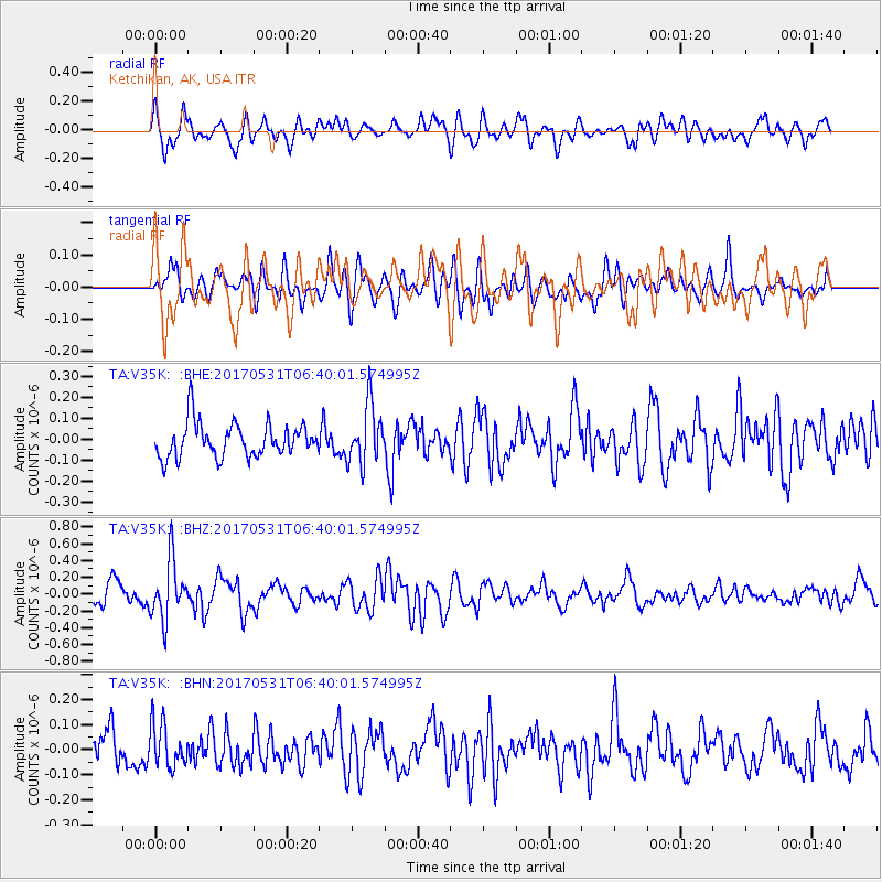
V35K Ketchikan, AK, USA - Earthquake Result Viewer
*The percent match for this event was below the threshold and hence no stack was calculated.
| Earthquake location: |
Mariana Islands |
| Earthquake latitude/longitude: |
19.1/145.9 |
| Earthquake time(UTC): |
2017/05/31 (151) 06:29:32 GMT |
| Earthquake Depth: |
121 km |
| Earthquake Magnitude: |
5.4 Mww |
| Earthquake Catalog/Contributor: |
NEIC PDE/us |
|
| Network: |
TA USArray Transportable Network (new EarthScope stations) |
| Station: |
V35K Ketchikan, AK, USA |
| Lat/Lon: |
55.33 N/131.62 W |
| Elevation: |
64 m |
|
| Distance: |
70.3 deg |
| Az: |
37.002 deg |
| Baz: |
275.177 deg |
| Ray Param: |
$rayparam |
*The percent match for this event was below the threshold and hence was not used in the summary stack. |
|
| Radial Match: |
70.53951 % |
| Radial Bump: |
400 |
| Transverse Match: |
62.066696 % |
| Transverse Bump: |
400 |
| SOD ConfigId: |
13570011 |
| Insert Time: |
2019-04-28 03:02:38.229 +0000 |
| GWidth: |
2.5 |
| Max Bumps: |
400 |
| Tol: |
0.001 |
|
Signal To Noise
| Channel | StoN | STA | LTA |
| TA:V35K: :BHZ:20170531T06:40:01.574995Z | 2.308072 | 3.513629E-7 | 1.522322E-7 |
| TA:V35K: :BHN:20170531T06:40:01.574995Z | 1.1390191 | 8.568174E-8 | 7.522414E-8 |
| TA:V35K: :BHE:20170531T06:40:01.574995Z | 1.7352524 | 1.420126E-7 | 8.183973E-8 |
| Arrivals |
| Ps | |
| PpPs | |
| PsPs/PpSs | |


