You are here: Home > Network List > US - United States National Seismic Network Stations List
> Station DUG Dugway, Tooele County, Utah, USA > Earthquake Result Viewer
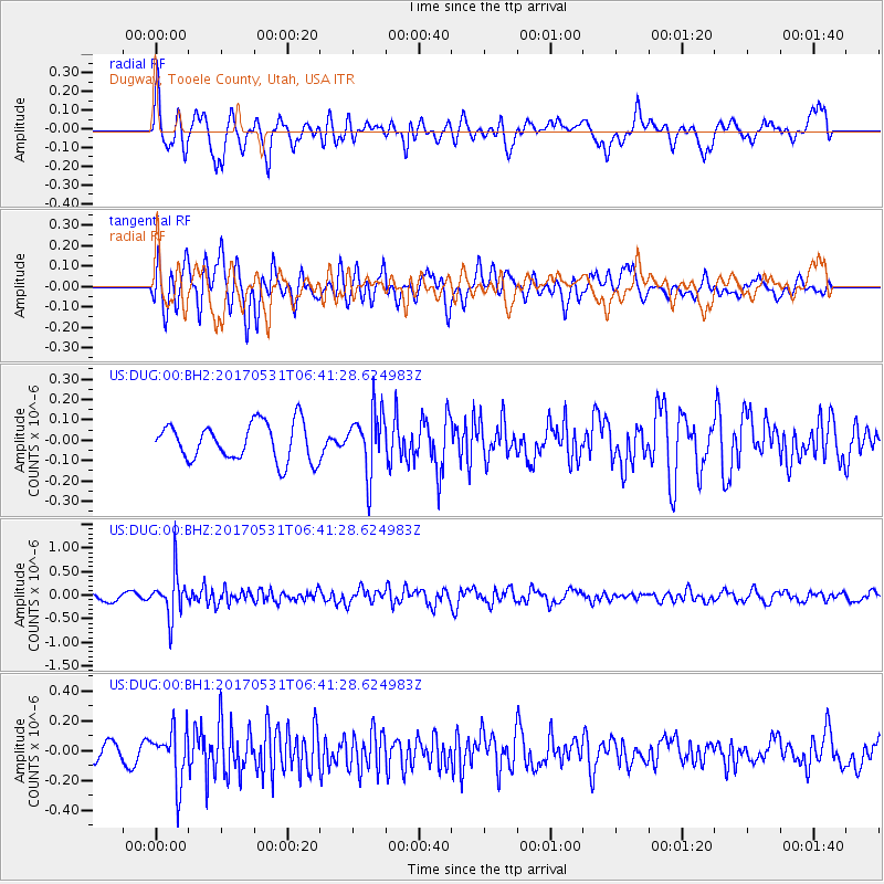
DUG Dugway, Tooele County, Utah, USA - Earthquake Result Viewer
*The percent match for this event was below the threshold and hence no stack was calculated.
| Earthquake location: |
Mariana Islands |
| Earthquake latitude/longitude: |
19.1/145.9 |
| Earthquake time(UTC): |
2017/05/31 (151) 06:29:32 GMT |
| Earthquake Depth: |
121 km |
| Earthquake Magnitude: |
5.4 Mww |
| Earthquake Catalog/Contributor: |
NEIC PDE/us |
|
| Network: |
US United States National Seismic Network |
| Station: |
DUG Dugway, Tooele County, Utah, USA |
| Lat/Lon: |
40.19 N/112.81 W |
| Elevation: |
1477 m |
|
| Distance: |
86.2 deg |
| Az: |
48.828 deg |
| Baz: |
291.677 deg |
| Ray Param: |
$rayparam |
*The percent match for this event was below the threshold and hence was not used in the summary stack. |
|
| Radial Match: |
74.857285 % |
| Radial Bump: |
400 |
| Transverse Match: |
68.6388 % |
| Transverse Bump: |
400 |
| SOD ConfigId: |
13570011 |
| Insert Time: |
2019-04-28 03:03:15.040 +0000 |
| GWidth: |
2.5 |
| Max Bumps: |
400 |
| Tol: |
0.001 |
|
Signal To Noise
| Channel | StoN | STA | LTA |
| US:DUG:00:BHZ:20170531T06:41:28.624983Z | 5.262125 | 4.6501475E-7 | 8.837014E-8 |
| US:DUG:00:BH1:20170531T06:41:28.624983Z | 2.6864634 | 1.7535878E-7 | 6.527496E-8 |
| US:DUG:00:BH2:20170531T06:41:28.624983Z | 1.6325946 | 1.5020116E-7 | 9.200151E-8 |
| Arrivals |
| Ps | |
| PpPs | |
| PsPs/PpSs | |


