You are here: Home > Network List > WI - West Indies IPGP Network Stations List
> Station MAGL Barre de l'ile, Saint louis, Marie Galante > Earthquake Result Viewer
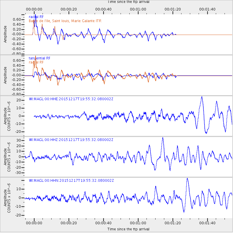
MAGL Barre de l'ile, Saint louis, Marie Galante - Earthquake Result Viewer
*The percent match for this event was below the threshold and hence no stack was calculated.
| Earthquake location: |
Near Coast Of Chiapas, Mexico |
| Earthquake latitude/longitude: |
15.9/-93.4 |
| Earthquake time(UTC): |
2015/12/17 (351) 19:49:54 GMT |
| Earthquake Depth: |
97 km |
| Earthquake Magnitude: |
6.4 MWB, 6.6 MI |
| Earthquake Catalog/Contributor: |
NEIC PDE/NEIC COMCAT |
|
| Network: |
WI West Indies IPGP Network |
| Station: |
MAGL Barre de l'ile, Saint louis, Marie Galante |
| Lat/Lon: |
15.95 N/61.28 W |
| Elevation: |
150 m |
|
| Distance: |
30.9 deg |
| Az: |
85.405 deg |
| Baz: |
274.388 deg |
| Ray Param: |
$rayparam |
*The percent match for this event was below the threshold and hence was not used in the summary stack. |
|
| Radial Match: |
76.82422 % |
| Radial Bump: |
264 |
| Transverse Match: |
54.93777 % |
| Transverse Bump: |
400 |
| SOD ConfigId: |
1259291 |
| Insert Time: |
2015-12-31 20:23:42.796 +0000 |
| GWidth: |
2.5 |
| Max Bumps: |
400 |
| Tol: |
0.001 |
|
Signal To Noise
| Channel | StoN | STA | LTA |
| WI:MAGL:00:HHZ:20151217T19:55:32.080002Z | 3.1965544 | 2.820234E-6 | 8.8227307E-7 |
| WI:MAGL:00:HHN:20151217T19:55:32.080002Z | 1.6365472 | 1.391524E-6 | 8.502804E-7 |
| WI:MAGL:00:HHE:20151217T19:55:32.080002Z | 2.4226956 | 2.5859347E-6 | 1.0673791E-6 |
| Arrivals |
| Ps | |
| PpPs | |
| PsPs/PpSs | |


