
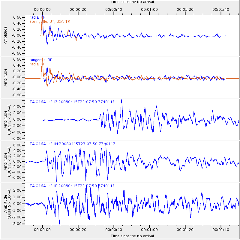
O16A Springville, UT, USA - Earthquake Result Viewer
| ||||||||||||||||||
| ||||||||||||||||||
| ||||||||||||||||||
|
Signal To Noise
| Channel | StoN | STA | LTA |
| TA:O16A: :BHN:20080415T23:07:50.774011Z | 9.270329 | 1.5960053E-6 | 1.7216274E-7 |
| TA:O16A: :BHE:20080415T23:07:50.774011Z | 8.559504 | 5.794281E-7 | 6.7694124E-8 |
| TA:O16A: :BHZ:20080415T23:07:50.774011Z | 7.8675804 | 1.0486904E-6 | 1.3329262E-7 |
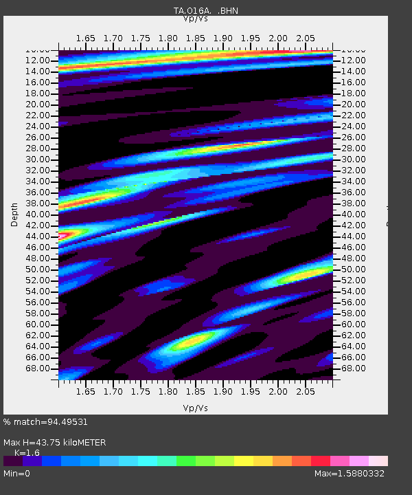
| Arrivals | |
| Ps | 4.5 SECOND |
| PpPs | 17 SECOND |
| PsPs/PpSs | 22 SECOND |

