O16A Springville, UT, USA - Earthquake Result Viewer
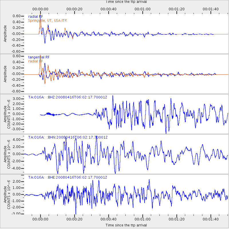
Earthquake location: Andreanof Islands, Aleutian Is.
Earthquake latitude/longitude: 51.9/-179.2
Earthquake time(UTC): 2008/04/16 (107) 05:54:19 GMT
Earthquake Depth: 13 km
Earthquake Magnitude: 6.1 MB, 6.5 MS, 6.6 MW, 6.6 MW
Earthquake Catalog/Contributor: WHDF/NEIC
Network: TA USArray Transportable Network (new EarthScope stations)
Station: O16A Springville, UT, USA
Lat/Lon: 40.21 N/111.50 W
Elevation: 1789 m
Distance: 46.8 deg
Az: 76.489 deg
Baz: 308.091 deg
Ray Param: 0.07043028
Estimated Moho Depth: 10.75 km
Estimated Crust Vp/Vs: 1.88
Assumed Crust Vp: 6.155 km/s
Estimated Crust Vs: 3.27 km/s
Estimated Crust Poisson's Ratio: 0.30
Radial Match: 92.67136 %
Radial Bump: 400
Transverse Match: 87.53023 %
Transverse Bump: 400
SOD ConfigId: 2504
Insert Time: 2010-03-06 00:20:39.169 +0000
GWidth: 2.5
Max Bumps: 400
Tol: 0.001

Signal To Noise

ChannelStoNSTALTA
TA:O16A: :BHN:20080416T06:02:17.70001Z9.9989367.865549E-77.866386E-8
TA:O16A: :BHE:20080416T06:02:17.70001Z2.82956242.3973365E-78.472464E-8
TA:O16A: :BHZ:20080416T06:02:17.70001Z2.76904323.4380454E-71.2416005E-7
Arrivals
Ps1.6 SECOND
PpPs4.8 SECOND
PsPs/PpSs6.4 SECOND