
O16A Springville, UT, USA - Earthquake Result Viewer
| ||||||||||||||||||
| ||||||||||||||||||
| ||||||||||||||||||
|
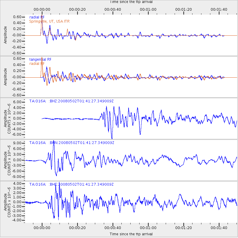
Signal To Noise
| Channel | StoN | STA | LTA |
| TA:O16A: :BHN:20080502T01:41:27.349009Z | 12.778546 | 1.5181502E-6 | 1.188046E-7 |
| TA:O16A: :BHE:20080502T01:41:27.349009Z | 4.0918293 | 3.8817265E-7 | 9.4865314E-8 |
| TA:O16A: :BHZ:20080502T01:41:27.349009Z | 6.102073 | 6.787774E-7 | 1.1123718E-7 |
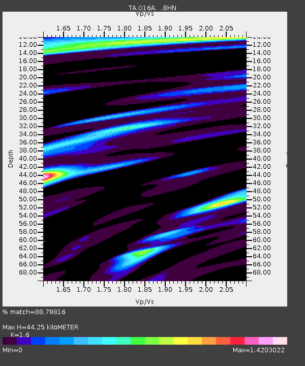
| Arrivals | |
| Ps | 4.6 SECOND |
| PpPs | 18 SECOND |
| PsPs/PpSs | 22 SECOND |

