
O16A Springville, UT, USA - Earthquake Result Viewer
| ||||||||||||||||||
| ||||||||||||||||||
| ||||||||||||||||||
|
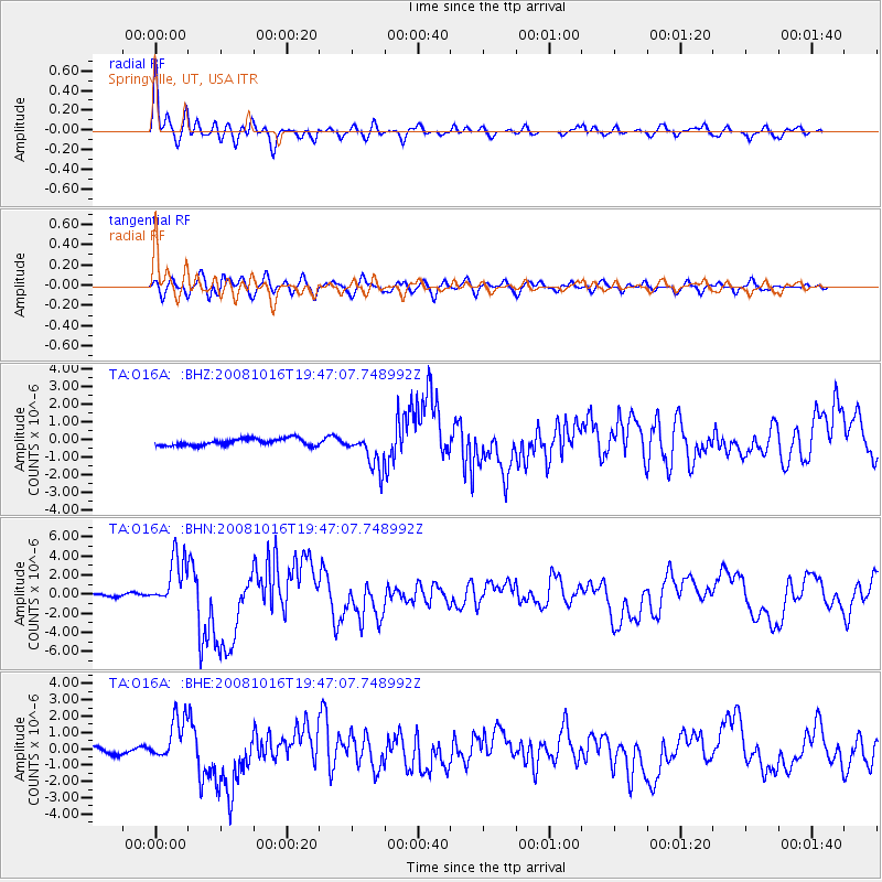
Signal To Noise
| Channel | StoN | STA | LTA |
| TA:O16A: :BHN:20081016T19:47:07.748992Z | 17.547691 | 2.6304392E-6 | 1.4990229E-7 |
| TA:O16A: :BHE:20081016T19:47:07.748992Z | 9.005107 | 1.3401406E-6 | 1.4882006E-7 |
| TA:O16A: :BHZ:20081016T19:47:07.748992Z | 5.203084 | 1.0099332E-6 | 1.941028E-7 |
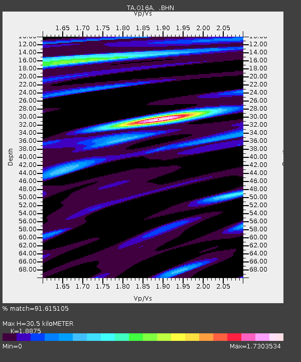
| Arrivals | |
| Ps | 4.7 SECOND |
| PpPs | 13 SECOND |
| PsPs/PpSs | 18 SECOND |

