You are here: Home > Network List > UW - Pacific Northwest Regional Seismic Network Stations List
> Station FISH Seaside, OR, USA > Earthquake Result Viewer
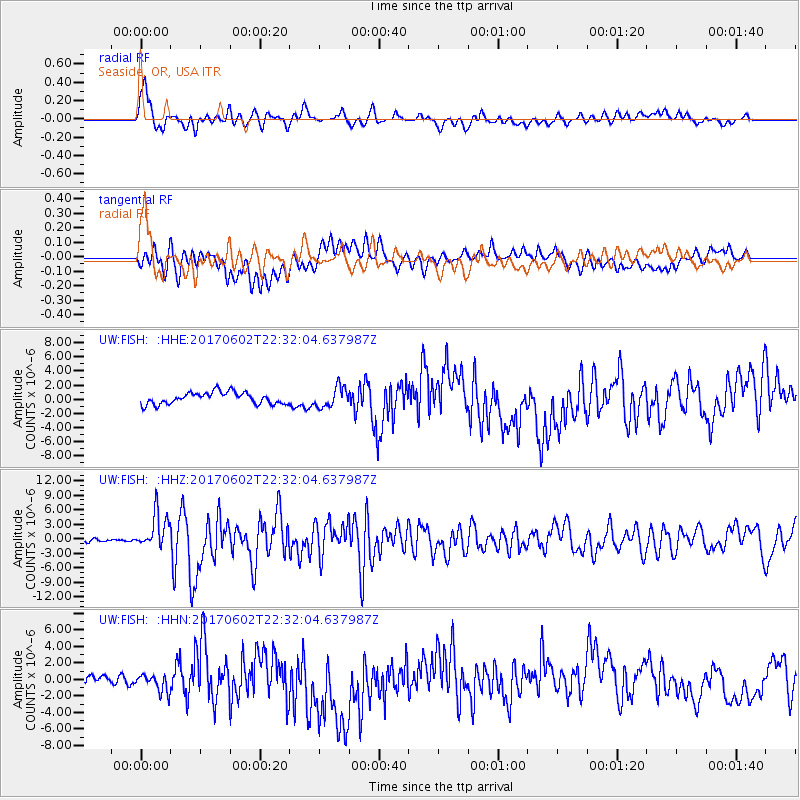
FISH Seaside, OR, USA - Earthquake Result Viewer
*The percent match for this event was below the threshold and hence no stack was calculated.
| Earthquake location: |
Near Islands, Aleutian Islands |
| Earthquake latitude/longitude: |
54.0/170.9 |
| Earthquake time(UTC): |
2017/06/02 (153) 22:24:47 GMT |
| Earthquake Depth: |
8.2 km |
| Earthquake Magnitude: |
6.8 Mww |
| Earthquake Catalog/Contributor: |
NEIC PDE/us |
|
| Network: |
UW Pacific Northwest Regional Seismic Network |
| Station: |
FISH Seaside, OR, USA |
| Lat/Lon: |
45.93 N/123.56 W |
| Elevation: |
325 m |
|
| Distance: |
41.5 deg |
| Az: |
73.424 deg |
| Baz: |
305.888 deg |
| Ray Param: |
$rayparam |
*The percent match for this event was below the threshold and hence was not used in the summary stack. |
|
| Radial Match: |
69.20665 % |
| Radial Bump: |
400 |
| Transverse Match: |
42.900265 % |
| Transverse Bump: |
400 |
| SOD ConfigId: |
13570011 |
| Insert Time: |
2019-04-28 03:17:17.790 +0000 |
| GWidth: |
2.5 |
| Max Bumps: |
400 |
| Tol: |
0.001 |
|
Signal To Noise
| Channel | StoN | STA | LTA |
| UW:FISH: :HHZ:20170602T22:32:04.637987Z | 13.702291 | 3.6776364E-6 | 2.6839575E-7 |
| UW:FISH: :HHN:20170602T22:32:04.637987Z | 2.5952723 | 1.1556576E-6 | 4.452934E-7 |
| UW:FISH: :HHE:20170602T22:32:04.637987Z | 1.7006449 | 1.4152663E-6 | 8.3219396E-7 |
| Arrivals |
| Ps | |
| PpPs | |
| PsPs/PpSs | |


