
O16A Springville, UT, USA - Earthquake Result Viewer
| ||||||||||||||||||
| ||||||||||||||||||
| ||||||||||||||||||
|
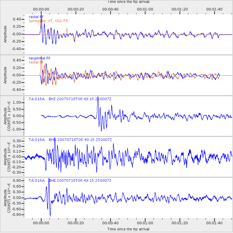
Signal To Noise
| Channel | StoN | STA | LTA |
| TA:O16A: :BHN:20070716T06:49:15.250007Z | 3.6636064 | 8.3441066E-8 | 2.2775662E-8 |
| TA:O16A: :BHE:20070716T06:49:15.250007Z | 9.640935 | 3.5828225E-7 | 3.7162604E-8 |
| TA:O16A: :BHZ:20070716T06:49:15.250007Z | 11.435338 | 5.3322685E-7 | 4.6629744E-8 |
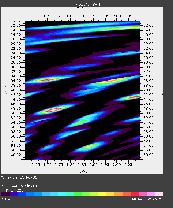
| Arrivals | |
| Ps | 5.8 SECOND |
| PpPs | 21 SECOND |
| PsPs/PpSs | 27 SECOND |

