You are here: Home > Network List > GS - US Geological Survey Networks Stations List
> Station KAN11 Stewart Ranch, Harper County, KS, USA > Earthquake Result Viewer
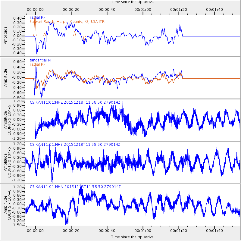
KAN11 Stewart Ranch, Harper County, KS, USA - Earthquake Result Viewer
*The percent match for this event was below the threshold and hence no stack was calculated.
| Earthquake location: |
North Of Ascension Island |
| Earthquake latitude/longitude: |
-1.4/-15.8 |
| Earthquake time(UTC): |
2015/12/18 (352) 11:46:48 GMT |
| Earthquake Depth: |
10 km |
| Earthquake Magnitude: |
5.6 MB |
| Earthquake Catalog/Contributor: |
NEIC PDE/NEIC COMCAT |
|
| Network: |
GS US Geological Survey Networks |
| Station: |
KAN11 Stewart Ranch, Harper County, KS, USA |
| Lat/Lon: |
37.21 N/97.91 W |
| Elevation: |
410 m |
|
| Distance: |
84.5 deg |
| Az: |
307.395 deg |
| Baz: |
95.861 deg |
| Ray Param: |
$rayparam |
*The percent match for this event was below the threshold and hence was not used in the summary stack. |
|
| Radial Match: |
50.824455 % |
| Radial Bump: |
400 |
| Transverse Match: |
52.31121 % |
| Transverse Bump: |
400 |
| SOD ConfigId: |
1259291 |
| Insert Time: |
2016-01-01 12:13:47.124 +0000 |
| GWidth: |
2.5 |
| Max Bumps: |
400 |
| Tol: |
0.001 |
|
Signal To Noise
| Channel | StoN | STA | LTA |
| GS:KAN11:01:HHZ:20151218T11:58:50.279014Z | 1.578112 | 4.3057733E-7 | 2.7284332E-7 |
| GS:KAN11:01:HHN:20151218T11:58:50.279014Z | 0.67928946 | 3.0076026E-7 | 4.4275714E-7 |
| GS:KAN11:01:HHE:20151218T11:58:50.279014Z | 1.7596285 | 5.7223116E-7 | 3.2519998E-7 |
| Arrivals |
| Ps | |
| PpPs | |
| PsPs/PpSs | |


