
O16A Springville, UT, USA - Earthquake Result Viewer
| ||||||||||||||||||
| ||||||||||||||||||
| ||||||||||||||||||
|
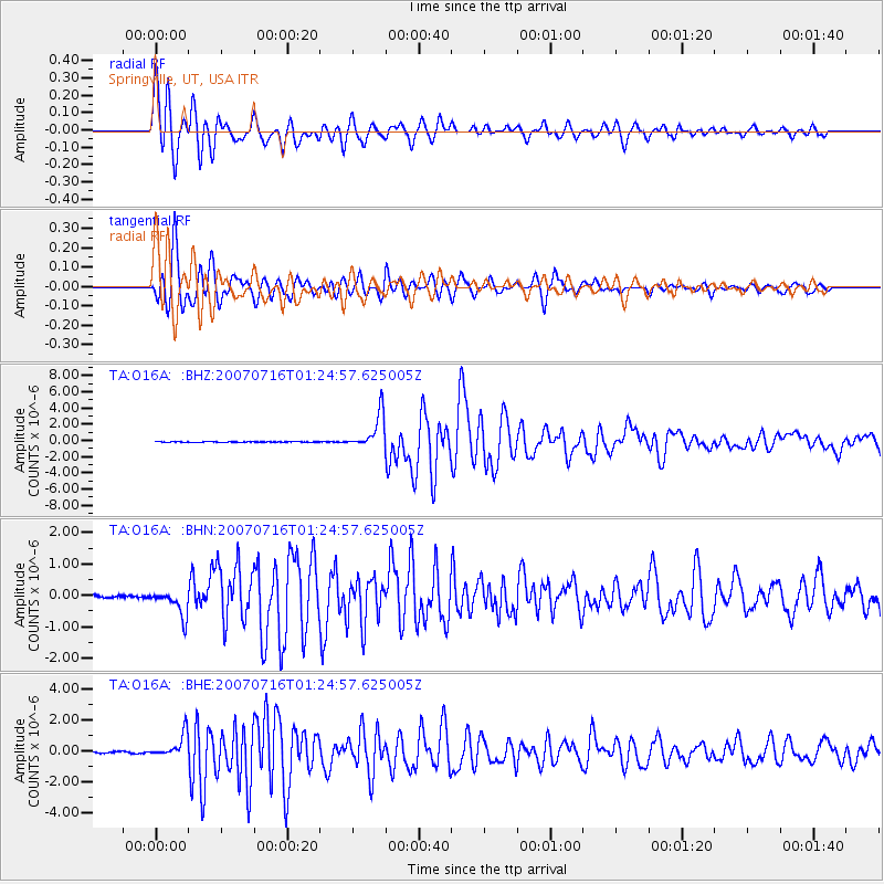
Signal To Noise
| Channel | StoN | STA | LTA |
| TA:O16A: :BHN:20070716T01:24:57.625005Z | 8.882678 | 4.2102923E-7 | 4.7398906E-8 |
| TA:O16A: :BHE:20070716T01:24:57.625005Z | 21.680193 | 7.600802E-7 | 3.5058736E-8 |
| TA:O16A: :BHZ:20070716T01:24:57.625005Z | 73.154495 | 2.1356518E-6 | 2.9193718E-8 |
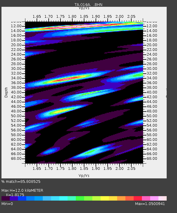
| Arrivals | |
| Ps | 1.6 SECOND |
| PpPs | 5.4 SECOND |
| PsPs/PpSs | 7.0 SECOND |

