
O16A Springville, UT, USA - Earthquake Result Viewer
| ||||||||||||||||||
| ||||||||||||||||||
| ||||||||||||||||||
|
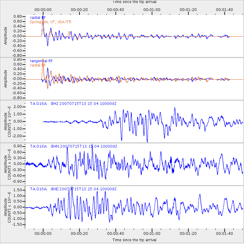
Signal To Noise
| Channel | StoN | STA | LTA |
| TA:O16A: :BHN:20070715T13:15:04.100009Z | 2.253617 | 1.0283238E-7 | 4.562993E-8 |
| TA:O16A: :BHE:20070715T13:15:04.100009Z | 3.6080146 | 1.6143133E-7 | 4.474243E-8 |
| TA:O16A: :BHZ:20070715T13:15:04.100009Z | 3.7909229 | 2.7686488E-7 | 7.303363E-8 |
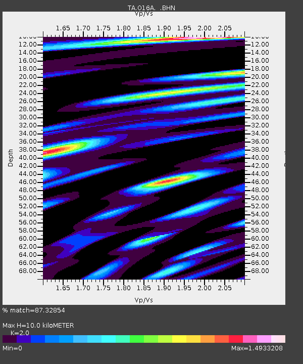
| Arrivals | |
| Ps | 1.7 SECOND |
| PpPs | 4.6 SECOND |
| PsPs/PpSs | 6.3 SECOND |

