O16A Springville, UT, USA - Earthquake Result Viewer
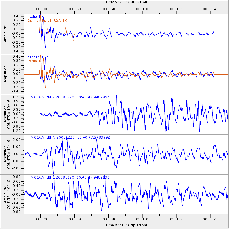
Earthquake location: Off East Coast Of Honshu, Japan
Earthquake latitude/longitude: 36.5/142.4
Earthquake time(UTC): 2008/12/20 (355) 10:29:23 GMT
Earthquake Depth: 19 km
Earthquake Magnitude: 6.0 MB, 6.3 MS, 6.3 MW, 6.3 MW
Earthquake Catalog/Contributor: WHDF/NEIC
Network: TA USArray Transportable Network (new EarthScope stations)
Station: O16A Springville, UT, USA
Lat/Lon: 40.21 N/111.50 W
Elevation: 1789 m
Distance: 77.9 deg
Az: 48.831 deg
Baz: 307.666 deg
Ray Param: 0.050023727
Estimated Moho Depth: 11.5 km
Estimated Crust Vp/Vs: 1.85
Assumed Crust Vp: 6.155 km/s
Estimated Crust Vs: 3.327 km/s
Estimated Crust Poisson's Ratio: 0.29
Radial Match: 83.047745 %
Radial Bump: 400
Transverse Match: 76.57379 %
Transverse Bump: 400
SOD ConfigId: 2658
Insert Time: 2010-03-06 00:22:03.981 +0000
GWidth: 2.5
Max Bumps: 400
Tol: 0.001

Signal To Noise

ChannelStoNSTALTA
TA:O16A: :BHN:20081220T10:40:47.948999Z5.16546445.582295E-71.08069564E-7
TA:O16A: :BHE:20081220T10:40:47.948999Z1.09385321.13159686E-71.03450525E-7
TA:O16A: :BHZ:20081220T10:40:47.948999Z3.03563262.2247954E-77.328935E-8
Arrivals
Ps1.6 SECOND
PpPs5.2 SECOND
PsPs/PpSs6.8 SECOND