O16A Springville, UT, USA - Earthquake Result Viewer
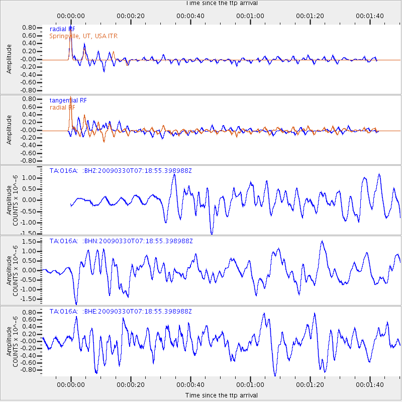
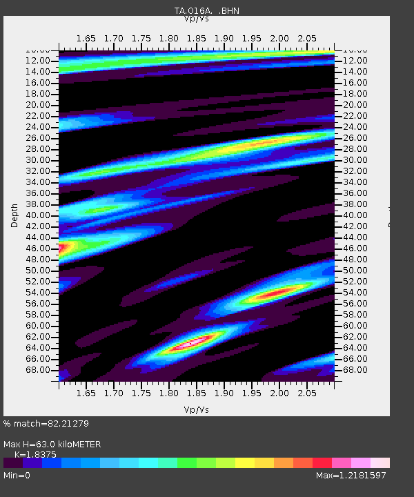
Earthquake location: Kodiak Island Region, Alaska
Earthquake latitude/longitude: 56.5/-152.7
Earthquake time(UTC): 2009/03/30 (089) 07:13:07 GMT
Earthquake Depth: 21 km
Earthquake Magnitude: 5.9 MB, 5.9 MS, 5.9 MW, 5.9 MW
Earthquake Catalog/Contributor: WHDF/NEIC
Network: TA USArray Transportable Network (new EarthScope stations)
Station: O16A Springville, UT, USA
Lat/Lon: 40.21 N/111.50 W
Elevation: 1789 m
Distance: 31.3 deg
Az: 103.731 deg
Baz: 315.371 deg
Ray Param: 0.07908839
Estimated Moho Depth: 63.0 km
Estimated Crust Vp/Vs: 1.84
Assumed Crust Vp: 6.155 km/s
Estimated Crust Vs: 3.35 km/s
Estimated Crust Poisson's Ratio: 0.29
Radial Match: 82.21279 %
Radial Bump: 367
Transverse Match: 66.768005 %
Transverse Bump: 400
SOD ConfigId: 2658
Insert Time: 2010-03-06 00:22:10.488 +0000
GWidth: 2.5
Max Bumps: 400
Tol: 0.001

Signal To Noise

ChannelStoNSTALTA
TA:O16A: :BHN:20090330T07:18:55.398988Z7.2003427.597723E-71.05518914E-7
TA:O16A: :BHE:20090330T07:18:55.398988Z4.39993142.987914E-76.7908196E-8
TA:O16A: :BHZ:20090330T07:18:55.398988Z4.85157256.257857E-71.2898614E-7
Arrivals
Ps9.2 SECOND
PpPs27 SECOND
PsPs/PpSs36 SECOND