You are here: Home > Network List > TA - USArray Transportable Network (new EarthScope stations) Stations List
> Station O16A Springville, UT, USA > Earthquake Result Viewer
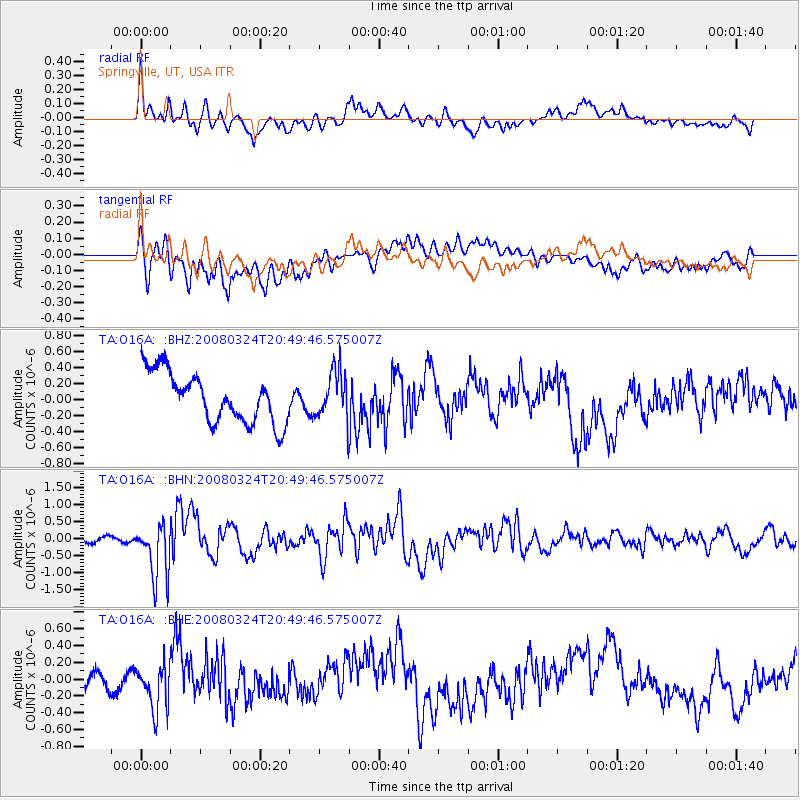
O16A Springville, UT, USA - Earthquake Result Viewer
*The percent match for this event was below the threshold and hence no stack was calculated.
| Earthquake location: |
Chile-Bolivia Border Region |
| Earthquake latitude/longitude: |
-20.0/-69.0 |
| Earthquake time(UTC): |
2008/03/24 (084) 20:39:07 GMT |
| Earthquake Depth: |
120 km |
| Earthquake Magnitude: |
5.7 MB, 6.2 MW, 6.1 MW |
| Earthquake Catalog/Contributor: |
WHDF/NEIC |
|
| Network: |
TA USArray Transportable Network (new EarthScope stations) |
| Station: |
O16A Springville, UT, USA |
| Lat/Lon: |
40.21 N/111.50 W |
| Elevation: |
1789 m |
|
| Distance: |
71.9 deg |
| Az: |
326.983 deg |
| Baz: |
138.016 deg |
| Ray Param: |
$rayparam |
*The percent match for this event was below the threshold and hence was not used in the summary stack. |
|
| Radial Match: |
50.09773 % |
| Radial Bump: |
400 |
| Transverse Match: |
44.990704 % |
| Transverse Bump: |
400 |
| SOD ConfigId: |
2504 |
| Insert Time: |
2010-03-06 00:22:25.225 +0000 |
| GWidth: |
2.5 |
| Max Bumps: |
400 |
| Tol: |
0.001 |
|
Signal To Noise
| Channel | StoN | STA | LTA |
| TA:O16A: :BHN:20080324T20:49:46.575007Z | 9.482797 | 8.156047E-7 | 8.600888E-8 |
| TA:O16A: :BHE:20080324T20:49:46.575007Z | 2.9456613 | 2.9215477E-7 | 9.9181385E-8 |
| TA:O16A: :BHZ:20080324T20:49:46.575007Z | 0.9626011 | 2.986558E-7 | 3.1025914E-7 |
| Arrivals |
| Ps | |
| PpPs | |
| PsPs/PpSs | |


