You are here: Home > Network List > TA - USArray Transportable Network (new EarthScope stations) Stations List
> Station O16A Springville, UT, USA > Earthquake Result Viewer
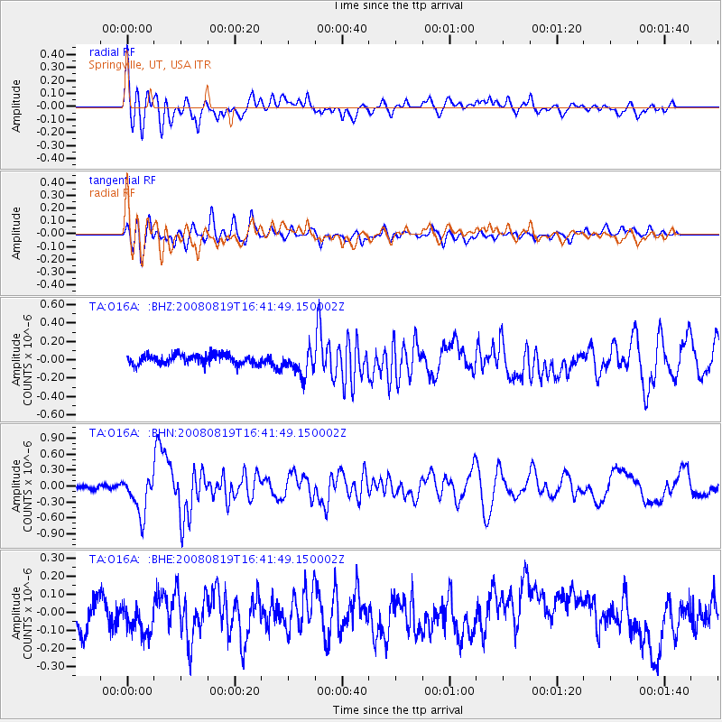
O16A Springville, UT, USA - Earthquake Result Viewer
*The percent match for this event was below the threshold and hence no stack was calculated.
| Earthquake location: |
Tonga Islands |
| Earthquake latitude/longitude: |
-15.1/-173.5 |
| Earthquake time(UTC): |
2008/08/19 (232) 16:30:13 GMT |
| Earthquake Depth: |
8.0 km |
| Earthquake Magnitude: |
5.6 MB, 5.9 MS, 6.1 MW, 6.0 MW |
| Earthquake Catalog/Contributor: |
WHDF/NEIC |
|
| Network: |
TA USArray Transportable Network (new EarthScope stations) |
| Station: |
O16A Springville, UT, USA |
| Lat/Lon: |
40.21 N/111.50 W |
| Elevation: |
1789 m |
|
| Distance: |
79.6 deg |
| Az: |
43.427 deg |
| Baz: |
240.119 deg |
| Ray Param: |
$rayparam |
*The percent match for this event was below the threshold and hence was not used in the summary stack. |
|
| Radial Match: |
72.308205 % |
| Radial Bump: |
400 |
| Transverse Match: |
71.17021 % |
| Transverse Bump: |
400 |
| SOD ConfigId: |
2504 |
| Insert Time: |
2010-03-06 00:22:44.775 +0000 |
| GWidth: |
2.5 |
| Max Bumps: |
400 |
| Tol: |
0.001 |
|
Signal To Noise
| Channel | StoN | STA | LTA |
| TA:O16A: :BHN:20080819T16:41:49.150002Z | 8.726718 | 3.6855212E-7 | 4.2232614E-8 |
| TA:O16A: :BHE:20080819T16:41:49.150002Z | 1.4698423 | 1.1041322E-7 | 7.511909E-8 |
| TA:O16A: :BHZ:20080819T16:41:49.150002Z | 2.597299 | 1.3489853E-7 | 5.1938002E-8 |
| Arrivals |
| Ps | |
| PpPs | |
| PsPs/PpSs | |


