You are here: Home > Network List > US - United States National Seismic Network Stations List
> Station CBKS Cedar Bluff, Kansas, USA > Earthquake Result Viewer
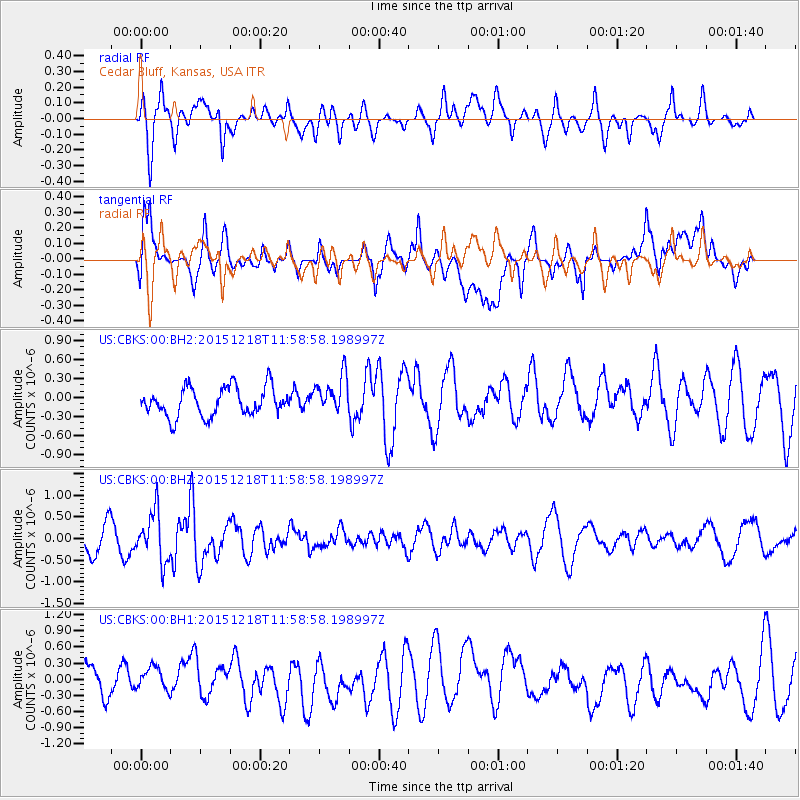
CBKS Cedar Bluff, Kansas, USA - Earthquake Result Viewer
*The percent match for this event was below the threshold and hence no stack was calculated.
| Earthquake location: |
North Of Ascension Island |
| Earthquake latitude/longitude: |
-1.4/-15.8 |
| Earthquake time(UTC): |
2015/12/18 (352) 11:46:48 GMT |
| Earthquake Depth: |
10 km |
| Earthquake Magnitude: |
5.6 MB |
| Earthquake Catalog/Contributor: |
NEIC PDE/NEIC COMCAT |
|
| Network: |
US United States National Seismic Network |
| Station: |
CBKS Cedar Bluff, Kansas, USA |
| Lat/Lon: |
38.81 N/99.74 W |
| Elevation: |
677 m |
|
| Distance: |
86.1 deg |
| Az: |
308.864 deg |
| Baz: |
94.863 deg |
| Ray Param: |
$rayparam |
*The percent match for this event was below the threshold and hence was not used in the summary stack. |
|
| Radial Match: |
59.952984 % |
| Radial Bump: |
400 |
| Transverse Match: |
48.571712 % |
| Transverse Bump: |
400 |
| SOD ConfigId: |
1259291 |
| Insert Time: |
2016-01-01 12:18:20.168 +0000 |
| GWidth: |
2.5 |
| Max Bumps: |
400 |
| Tol: |
0.001 |
|
Signal To Noise
| Channel | StoN | STA | LTA |
| US:CBKS:00:BHZ:20151218T11:58:58.198997Z | 1.6832056 | 5.642915E-7 | 3.3524807E-7 |
| US:CBKS:00:BH1:20151218T11:58:58.198997Z | 0.52497625 | 2.3940368E-7 | 4.5602764E-7 |
| US:CBKS:00:BH2:20151218T11:58:58.198997Z | 1.3278906 | 2.992585E-7 | 2.2536382E-7 |
| Arrivals |
| Ps | |
| PpPs | |
| PsPs/PpSs | |


