You are here: Home > Network List > US - United States National Seismic Network Stations List
> Station ERPA Erie, Pennsylvania, USA > Earthquake Result Viewer
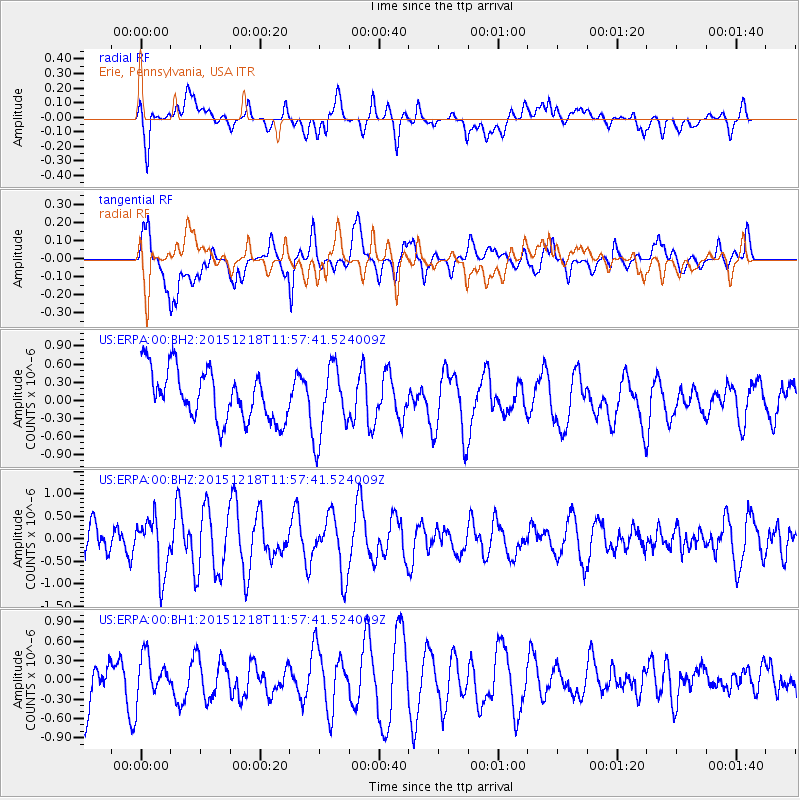
ERPA Erie, Pennsylvania, USA - Earthquake Result Viewer
*The percent match for this event was below the threshold and hence no stack was calculated.
| Earthquake location: |
North Of Ascension Island |
| Earthquake latitude/longitude: |
-1.4/-15.8 |
| Earthquake time(UTC): |
2015/12/18 (352) 11:46:48 GMT |
| Earthquake Depth: |
10 km |
| Earthquake Magnitude: |
5.6 MB |
| Earthquake Catalog/Contributor: |
NEIC PDE/NEIC COMCAT |
|
| Network: |
US United States National Seismic Network |
| Station: |
ERPA Erie, Pennsylvania, USA |
| Lat/Lon: |
42.12 N/79.99 W |
| Elevation: |
306 m |
|
| Distance: |
72.0 deg |
| Az: |
315.255 deg |
| Baz: |
108.932 deg |
| Ray Param: |
$rayparam |
*The percent match for this event was below the threshold and hence was not used in the summary stack. |
|
| Radial Match: |
59.152073 % |
| Radial Bump: |
400 |
| Transverse Match: |
61.764175 % |
| Transverse Bump: |
400 |
| SOD ConfigId: |
1259291 |
| Insert Time: |
2016-01-01 12:18:30.473 +0000 |
| GWidth: |
2.5 |
| Max Bumps: |
400 |
| Tol: |
0.001 |
|
Signal To Noise
| Channel | StoN | STA | LTA |
| US:ERPA:00:BHZ:20151218T11:57:41.524009Z | 1.261782 | 6.1470774E-7 | 4.871743E-7 |
| US:ERPA:00:BH1:20151218T11:57:41.524009Z | 0.66461235 | 3.093676E-7 | 4.6548578E-7 |
| US:ERPA:00:BH2:20151218T11:57:41.524009Z | 1.4229702 | 5.8963326E-7 | 4.1436795E-7 |
| Arrivals |
| Ps | |
| PpPs | |
| PsPs/PpSs | |


