You are here: Home > Network List > TA - USArray Transportable Network (new EarthScope stations) Stations List
> Station O17K Koliganek, Bristol Bay, AK, USA > Earthquake Result Viewer
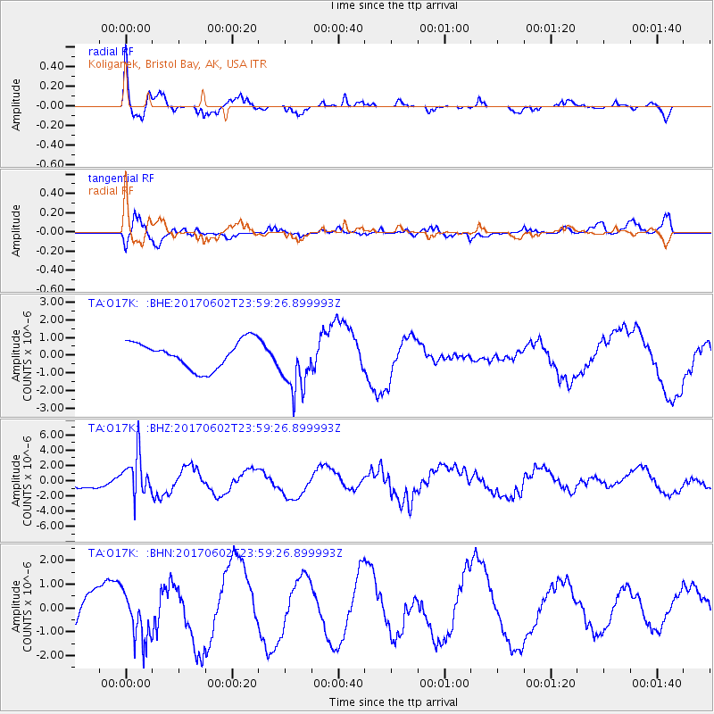
O17K Koliganek, Bristol Bay, AK, USA - Earthquake Result Viewer
*The percent match for this event was below the threshold and hence no stack was calculated.
| Earthquake location: |
Near N Coast Of New Guinea, P.N.G. |
| Earthquake latitude/longitude: |
-4.7/145.1 |
| Earthquake time(UTC): |
2017/06/02 (153) 23:48:17 GMT |
| Earthquake Depth: |
194 km |
| Earthquake Magnitude: |
5.9 Mww |
| Earthquake Catalog/Contributor: |
NEIC PDE/us |
|
| Network: |
TA USArray Transportable Network (new EarthScope stations) |
| Station: |
O17K Koliganek, Bristol Bay, AK, USA |
| Lat/Lon: |
59.77 N/157.09 W |
| Elevation: |
156 m |
|
| Distance: |
78.6 deg |
| Az: |
25.89 deg |
| Baz: |
239.327 deg |
| Ray Param: |
$rayparam |
*The percent match for this event was below the threshold and hence was not used in the summary stack. |
|
| Radial Match: |
62.574947 % |
| Radial Bump: |
378 |
| Transverse Match: |
61.17559 % |
| Transverse Bump: |
400 |
| SOD ConfigId: |
13570011 |
| Insert Time: |
2019-04-28 03:21:50.326 +0000 |
| GWidth: |
2.5 |
| Max Bumps: |
400 |
| Tol: |
0.001 |
|
Signal To Noise
| Channel | StoN | STA | LTA |
| TA:O17K: :BHZ:20170602T23:59:26.899993Z | 3.955203 | 2.7364301E-6 | 6.918558E-7 |
| TA:O17K: :BHN:20170602T23:59:26.899993Z | 1.1631594 | 1.0145452E-6 | 8.722323E-7 |
| TA:O17K: :BHE:20170602T23:59:26.899993Z | 2.1325698 | 1.6315148E-6 | 7.6504637E-7 |
| Arrivals |
| Ps | |
| PpPs | |
| PsPs/PpSs | |


