You are here: Home > Network List > TA - USArray Transportable Network (new EarthScope stations) Stations List
> Station O16A Springville, UT, USA > Earthquake Result Viewer
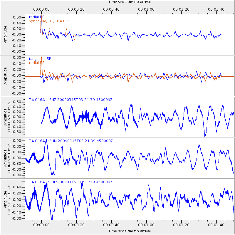
O16A Springville, UT, USA - Earthquake Result Viewer
*The percent match for this event was below the threshold and hence no stack was calculated.
| Earthquake location: |
Galapagos Islands Region |
| Earthquake latitude/longitude: |
2.4/-95.1 |
| Earthquake time(UTC): |
2009/03/15 (074) 03:14:31 GMT |
| Earthquake Depth: |
10 km |
| Earthquake Magnitude: |
5.5 MS, 5.4 MB, 5.8 MW, 5.8 MW |
| Earthquake Catalog/Contributor: |
WHDF/NEIC |
|
| Network: |
TA USArray Transportable Network (new EarthScope stations) |
| Station: |
O16A Springville, UT, USA |
| Lat/Lon: |
40.21 N/111.50 W |
| Elevation: |
1789 m |
|
| Distance: |
40.4 deg |
| Az: |
340.549 deg |
| Baz: |
154.252 deg |
| Ray Param: |
$rayparam |
*The percent match for this event was below the threshold and hence was not used in the summary stack. |
|
| Radial Match: |
76.69477 % |
| Radial Bump: |
352 |
| Transverse Match: |
49.243286 % |
| Transverse Bump: |
384 |
| SOD ConfigId: |
2658 |
| Insert Time: |
2010-03-06 00:23:07.734 +0000 |
| GWidth: |
2.5 |
| Max Bumps: |
400 |
| Tol: |
0.001 |
|
Signal To Noise
| Channel | StoN | STA | LTA |
| TA:O16A: :BHN:20090315T03:21:39.450009Z | 4.2103353 | 4.8322187E-7 | 1.147704E-7 |
| TA:O16A: :BHE:20090315T03:21:39.450009Z | 2.073229 | 2.86838E-7 | 1.3835326E-7 |
| TA:O16A: :BHZ:20090315T03:21:39.450009Z | 0.8458498 | 1.9217242E-7 | 2.271945E-7 |
| Arrivals |
| Ps | |
| PpPs | |
| PsPs/PpSs | |


