You are here: Home > Network List > AK - Alaska Regional Network Stations List
> Station MDM Murphy Dome > Earthquake Result Viewer
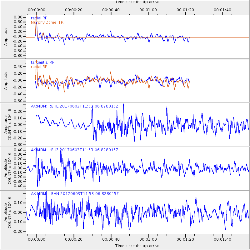
MDM Murphy Dome - Earthquake Result Viewer
*The percent match for this event was below the threshold and hence no stack was calculated.
| Earthquake location: |
Kuril Islands |
| Earthquake latitude/longitude: |
50.9/157.3 |
| Earthquake time(UTC): |
2017/06/03 (154) 11:47:23 GMT |
| Earthquake Depth: |
44 km |
| Earthquake Magnitude: |
5.1 Mww |
| Earthquake Catalog/Contributor: |
NEIC PDE/us |
|
| Network: |
AK Alaska Regional Network |
| Station: |
MDM Murphy Dome |
| Lat/Lon: |
64.96 N/148.23 W |
| Elevation: |
634 m |
|
| Distance: |
31.1 deg |
| Az: |
42.195 deg |
| Baz: |
269.582 deg |
| Ray Param: |
$rayparam |
*The percent match for this event was below the threshold and hence was not used in the summary stack. |
|
| Radial Match: |
48.502205 % |
| Radial Bump: |
400 |
| Transverse Match: |
48.839886 % |
| Transverse Bump: |
400 |
| SOD ConfigId: |
13570011 |
| Insert Time: |
2019-04-28 03:23:17.274 +0000 |
| GWidth: |
2.5 |
| Max Bumps: |
400 |
| Tol: |
0.001 |
|
Signal To Noise
| Channel | StoN | STA | LTA |
| AK:MDM: :BHZ:20170603T11:53:06.828015Z | 3.5809255 | 1.8728285E-7 | 5.2300123E-8 |
| AK:MDM: :BHN:20170603T11:53:06.828015Z | 1.9954976 | 9.931382E-8 | 4.9768953E-8 |
| AK:MDM: :BHE:20170603T11:53:06.828015Z | 2.5804598 | 1.2768128E-7 | 4.9480043E-8 |
| Arrivals |
| Ps | |
| PpPs | |
| PsPs/PpSs | |


