You are here: Home > Network List > TA - USArray Transportable Network (new EarthScope stations) Stations List
> Station O16A Springville, UT, USA > Earthquake Result Viewer
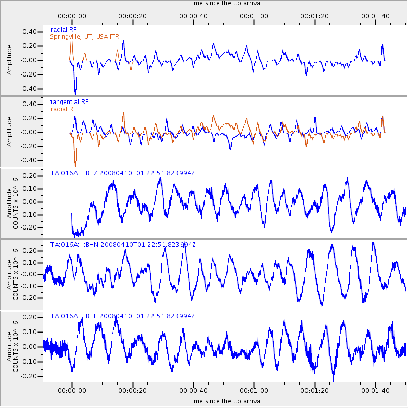
O16A Springville, UT, USA - Earthquake Result Viewer
*The percent match for this event was below the threshold and hence no stack was calculated.
| Earthquake location: |
Loyalty Islands |
| Earthquake latitude/longitude: |
-20.3/168.9 |
| Earthquake time(UTC): |
2008/04/10 (101) 01:10:02 GMT |
| Earthquake Depth: |
35 km |
| Earthquake Magnitude: |
5.5 MB, 5.5 MS, 5.8 MW |
| Earthquake Catalog/Contributor: |
WHDF/NEIC |
|
| Network: |
TA USArray Transportable Network (new EarthScope stations) |
| Station: |
O16A Springville, UT, USA |
| Lat/Lon: |
40.21 N/111.50 W |
| Elevation: |
1789 m |
|
| Distance: |
95.3 deg |
| Az: |
49.146 deg |
| Baz: |
247.946 deg |
| Ray Param: |
$rayparam |
*The percent match for this event was below the threshold and hence was not used in the summary stack. |
|
| Radial Match: |
40.9458 % |
| Radial Bump: |
400 |
| Transverse Match: |
42.77923 % |
| Transverse Bump: |
400 |
| SOD ConfigId: |
2504 |
| Insert Time: |
2010-03-06 00:23:21.504 +0000 |
| GWidth: |
2.5 |
| Max Bumps: |
400 |
| Tol: |
0.001 |
|
Signal To Noise
| Channel | StoN | STA | LTA |
| TA:O16A: :BHN:20080410T01:22:51.823994Z | 2.1530848 | 9.777596E-8 | 4.5412037E-8 |
| TA:O16A: :BHE:20080410T01:22:51.823994Z | 1.4800289 | 1.3467027E-7 | 9.099165E-8 |
| TA:O16A: :BHZ:20080410T01:22:51.823994Z | 1.1919674 | 1.3368226E-7 | 1.1215263E-7 |
| Arrivals |
| Ps | |
| PpPs | |
| PsPs/PpSs | |


