You are here: Home > Network List > CI - Caltech Regional Seismic Network Stations List
> Station DAN Danby, California, USA > Earthquake Result Viewer
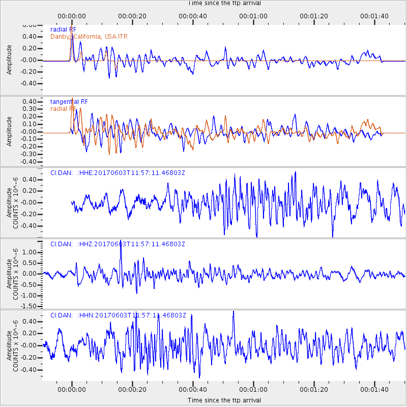
DAN Danby, California, USA - Earthquake Result Viewer
*The percent match for this event was below the threshold and hence no stack was calculated.
| Earthquake location: |
Kuril Islands |
| Earthquake latitude/longitude: |
50.9/157.3 |
| Earthquake time(UTC): |
2017/06/03 (154) 11:47:23 GMT |
| Earthquake Depth: |
44 km |
| Earthquake Magnitude: |
5.1 Mww |
| Earthquake Catalog/Contributor: |
NEIC PDE/us |
|
| Network: |
CI Caltech Regional Seismic Network |
| Station: |
DAN Danby, California, USA |
| Lat/Lon: |
34.64 N/115.38 W |
| Elevation: |
398 m |
|
| Distance: |
62.5 deg |
| Az: |
68.23 deg |
| Baz: |
314.465 deg |
| Ray Param: |
$rayparam |
*The percent match for this event was below the threshold and hence was not used in the summary stack. |
|
| Radial Match: |
66.349976 % |
| Radial Bump: |
400 |
| Transverse Match: |
70.56985 % |
| Transverse Bump: |
400 |
| SOD ConfigId: |
13570011 |
| Insert Time: |
2019-04-28 03:24:25.621 +0000 |
| GWidth: |
2.5 |
| Max Bumps: |
400 |
| Tol: |
0.001 |
|
Signal To Noise
| Channel | StoN | STA | LTA |
| CI:DAN: :HHZ:20170603T11:57:11.46803Z | 3.353876 | 2.7789426E-7 | 8.285764E-8 |
| CI:DAN: :HHN:20170603T11:57:11.46803Z | 0.96979964 | 9.138838E-8 | 9.423429E-8 |
| CI:DAN: :HHE:20170603T11:57:11.46803Z | 1.4170921 | 1.4778878E-7 | 1.0429017E-7 |
| Arrivals |
| Ps | |
| PpPs | |
| PsPs/PpSs | |


