You are here: Home > Network List > TA - USArray Transportable Network (new EarthScope stations) Stations List
> Station MDND Maddock, ND, USA > Earthquake Result Viewer
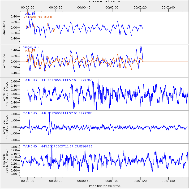
MDND Maddock, ND, USA - Earthquake Result Viewer
*The percent match for this event was below the threshold and hence no stack was calculated.
| Earthquake location: |
Kuril Islands |
| Earthquake latitude/longitude: |
50.9/157.3 |
| Earthquake time(UTC): |
2017/06/03 (154) 11:47:23 GMT |
| Earthquake Depth: |
44 km |
| Earthquake Magnitude: |
5.1 Mww |
| Earthquake Catalog/Contributor: |
NEIC PDE/us |
|
| Network: |
TA USArray Transportable Network (new EarthScope stations) |
| Station: |
MDND Maddock, ND, USA |
| Lat/Lon: |
47.85 N/99.60 W |
| Elevation: |
479 m |
|
| Distance: |
61.6 deg |
| Az: |
48.195 deg |
| Baz: |
315.474 deg |
| Ray Param: |
$rayparam |
*The percent match for this event was below the threshold and hence was not used in the summary stack. |
|
| Radial Match: |
62.64902 % |
| Radial Bump: |
400 |
| Transverse Match: |
65.39522 % |
| Transverse Bump: |
400 |
| SOD ConfigId: |
13570011 |
| Insert Time: |
2019-04-28 03:31:39.431 +0000 |
| GWidth: |
2.5 |
| Max Bumps: |
400 |
| Tol: |
0.001 |
|
Signal To Noise
| Channel | StoN | STA | LTA |
| TA:MDND: :HHZ:20170603T11:57:05.839978Z | 4.2382894 | 3.5113726E-7 | 8.284882E-8 |
| TA:MDND: :HHN:20170603T11:57:05.839978Z | 0.5789123 | 1.1061089E-7 | 1.9106676E-7 |
| TA:MDND: :HHE:20170603T11:57:05.839978Z | 1.8067105 | 3.5364326E-7 | 1.9573875E-7 |
| Arrivals |
| Ps | |
| PpPs | |
| PsPs/PpSs | |


