You are here: Home > Network List > TA - USArray Transportable Network (new EarthScope stations) Stations List
> Station T31A Randall Ranch, Ashland, KS, USA > Earthquake Result Viewer
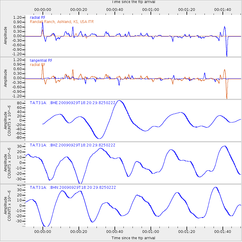
T31A Randall Ranch, Ashland, KS, USA - Earthquake Result Viewer
*The percent match for this event was below the threshold and hence no stack was calculated.
| Earthquake location: |
Samoa Islands Region |
| Earthquake latitude/longitude: |
-15.6/-172.0 |
| Earthquake time(UTC): |
2009/09/29 (272) 18:08:21 GMT |
| Earthquake Depth: |
10 km |
| Earthquake Magnitude: |
5.6 MB |
| Earthquake Catalog/Contributor: |
WHDF/NEIC |
|
| Network: |
TA USArray Transportable Network (new EarthScope stations) |
| Station: |
T31A Randall Ranch, Ashland, KS, USA |
| Lat/Lon: |
37.10 N/99.68 W |
| Elevation: |
564 m |
|
| Distance: |
85.8 deg |
| Az: |
49.813 deg |
| Baz: |
247.058 deg |
| Ray Param: |
$rayparam |
*The percent match for this event was below the threshold and hence was not used in the summary stack. |
|
| Radial Match: |
21.500313 % |
| Radial Bump: |
400 |
| Transverse Match: |
70.004265 % |
| Transverse Bump: |
201 |
| SOD ConfigId: |
2622 |
| Insert Time: |
2010-03-06 00:25:18.320 +0000 |
| GWidth: |
2.5 |
| Max Bumps: |
400 |
| Tol: |
0.001 |
|
Signal To Noise
| Channel | StoN | STA | LTA |
| TA:T31A: :BHZ:20090929T18:20:29.825022Z | 1.803593 | 2.0840518E-5 | 1.1555001E-5 |
| TA:T31A: :BHN:20090929T18:20:29.825022Z | 2.5569093 | 3.8198166E-5 | 1.49391935E-5 |
| TA:T31A: :BHE:20090929T18:20:29.825022Z | 6.312385 | 8.3825995E-5 | 1.3279608E-5 |
| Arrivals |
| Ps | |
| PpPs | |
| PsPs/PpSs | |


