You are here: Home > Network List > UW - Pacific Northwest Regional Seismic Network Stations List
> Station MRBL Marblemount, WA, USA > Earthquake Result Viewer
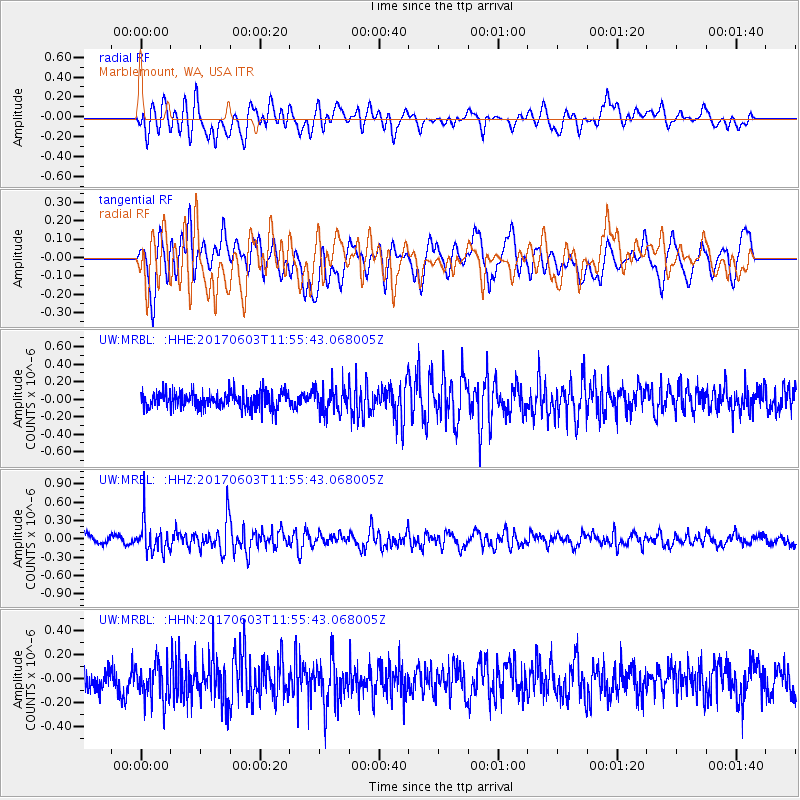
MRBL Marblemount, WA, USA - Earthquake Result Viewer
*The percent match for this event was below the threshold and hence no stack was calculated.
| Earthquake location: |
Kuril Islands |
| Earthquake latitude/longitude: |
50.9/157.3 |
| Earthquake time(UTC): |
2017/06/03 (154) 11:47:23 GMT |
| Earthquake Depth: |
44 km |
| Earthquake Magnitude: |
5.1 Mww |
| Earthquake Catalog/Contributor: |
NEIC PDE/us |
|
| Network: |
UW Pacific Northwest Regional Seismic Network |
| Station: |
MRBL Marblemount, WA, USA |
| Lat/Lon: |
48.52 N/121.48 W |
| Elevation: |
75 m |
|
| Distance: |
50.1 deg |
| Az: |
58.992 deg |
| Baz: |
305.23 deg |
| Ray Param: |
$rayparam |
*The percent match for this event was below the threshold and hence was not used in the summary stack. |
|
| Radial Match: |
64.653564 % |
| Radial Bump: |
400 |
| Transverse Match: |
63.05655 % |
| Transverse Bump: |
400 |
| SOD ConfigId: |
13570011 |
| Insert Time: |
2019-04-28 03:32:40.099 +0000 |
| GWidth: |
2.5 |
| Max Bumps: |
400 |
| Tol: |
0.001 |
|
Signal To Noise
| Channel | StoN | STA | LTA |
| UW:MRBL: :HHZ:20170603T11:55:43.068005Z | 4.2712116 | 2.4658598E-7 | 5.7732095E-8 |
| UW:MRBL: :HHN:20170603T11:55:43.068005Z | 1.4871083 | 1.5274215E-7 | 1.0271084E-7 |
| UW:MRBL: :HHE:20170603T11:55:43.068005Z | 1.5332001 | 1.4060802E-7 | 9.170885E-8 |
| Arrivals |
| Ps | |
| PpPs | |
| PsPs/PpSs | |


