You are here: Home > Network List > AZ - ANZA Regional Network Stations List
> Station SMER AZ.SMER > Earthquake Result Viewer
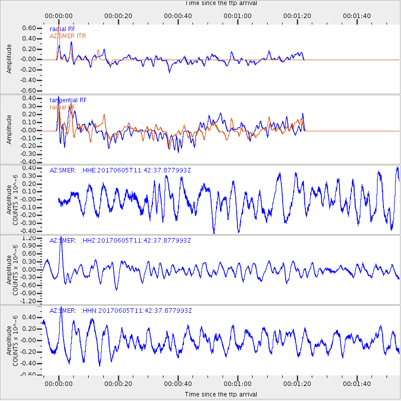
SMER AZ.SMER - Earthquake Result Viewer
*The percent match for this event was below the threshold and hence no stack was calculated.
| Earthquake location: |
Peru-Ecuador Border Region |
| Earthquake latitude/longitude: |
-4.1/-80.4 |
| Earthquake time(UTC): |
2017/06/05 (156) 11:34:11 GMT |
| Earthquake Depth: |
51 km |
| Earthquake Magnitude: |
5.6 Mww |
| Earthquake Catalog/Contributor: |
NEIC PDE/us |
|
| Network: |
AZ ANZA Regional Network |
| Station: |
SMER AZ.SMER |
| Lat/Lon: |
33.46 N/117.17 W |
| Elevation: |
355 m |
|
| Distance: |
51.0 deg |
| Az: |
319.921 deg |
| Baz: |
129.807 deg |
| Ray Param: |
$rayparam |
*The percent match for this event was below the threshold and hence was not used in the summary stack. |
|
| Radial Match: |
49.886852 % |
| Radial Bump: |
400 |
| Transverse Match: |
63.9059 % |
| Transverse Bump: |
400 |
| SOD ConfigId: |
13570011 |
| Insert Time: |
2019-04-28 03:36:54.261 +0000 |
| GWidth: |
2.5 |
| Max Bumps: |
400 |
| Tol: |
0.001 |
|
Signal To Noise
| Channel | StoN | STA | LTA |
| AZ:SMER: :HHZ:20170605T11:42:37.877993Z | 2.5578275 | 5.0460017E-7 | 1.9727686E-7 |
| AZ:SMER: :HHN:20170605T11:42:37.877993Z | 1.3171577 | 2.8578265E-7 | 2.1696918E-7 |
| AZ:SMER: :HHE:20170605T11:42:37.877993Z | 1.2515508 | 1.2523653E-7 | 1.0006508E-7 |
| Arrivals |
| Ps | |
| PpPs | |
| PsPs/PpSs | |


