You are here: Home > Network List > CI - Caltech Regional Seismic Network Stations List
> Station DAN Danby, California, USA > Earthquake Result Viewer
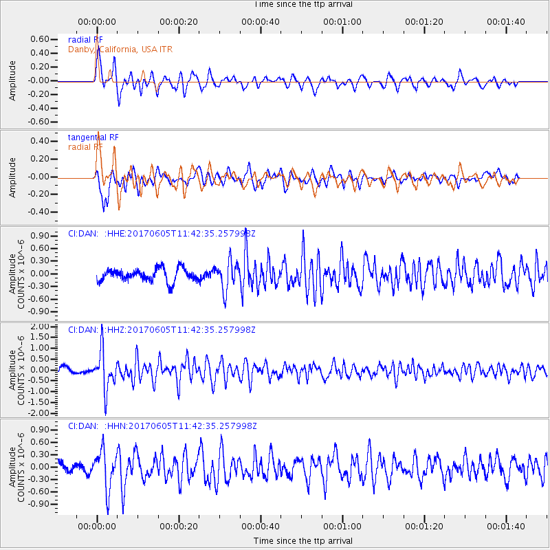
DAN Danby, California, USA - Earthquake Result Viewer
*The percent match for this event was below the threshold and hence no stack was calculated.
| Earthquake location: |
Peru-Ecuador Border Region |
| Earthquake latitude/longitude: |
-4.1/-80.4 |
| Earthquake time(UTC): |
2017/06/05 (156) 11:34:11 GMT |
| Earthquake Depth: |
51 km |
| Earthquake Magnitude: |
5.6 Mww |
| Earthquake Catalog/Contributor: |
NEIC PDE/us |
|
| Network: |
CI Caltech Regional Seismic Network |
| Station: |
DAN Danby, California, USA |
| Lat/Lon: |
34.64 N/115.38 W |
| Elevation: |
398 m |
|
| Distance: |
50.7 deg |
| Az: |
322.323 deg |
| Baz: |
132.321 deg |
| Ray Param: |
$rayparam |
*The percent match for this event was below the threshold and hence was not used in the summary stack. |
|
| Radial Match: |
76.83321 % |
| Radial Bump: |
400 |
| Transverse Match: |
78.84166 % |
| Transverse Bump: |
400 |
| SOD ConfigId: |
13570011 |
| Insert Time: |
2019-04-28 03:38:05.953 +0000 |
| GWidth: |
2.5 |
| Max Bumps: |
400 |
| Tol: |
0.001 |
|
Signal To Noise
| Channel | StoN | STA | LTA |
| CI:DAN: :HHZ:20170605T11:42:35.257998Z | 5.114472 | 9.109292E-7 | 1.7810815E-7 |
| CI:DAN: :HHN:20170605T11:42:35.257998Z | 3.2313745 | 4.6464098E-7 | 1.4379052E-7 |
| CI:DAN: :HHE:20170605T11:42:35.257998Z | 2.2844045 | 3.4577624E-7 | 1.5136385E-7 |
| Arrivals |
| Ps | |
| PpPs | |
| PsPs/PpSs | |


