You are here: Home > Network List > TA - USArray Transportable Network (new EarthScope stations) Stations List
> Station N24A Carr, CO, USA > Earthquake Result Viewer
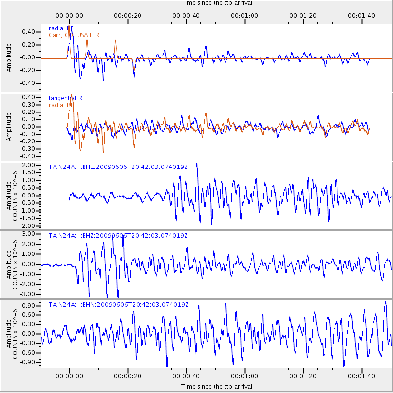
N24A Carr, CO, USA - Earthquake Result Viewer

| Earthquake location: |
Northern Mid-Atlantic Ridge |
| Earthquake latitude/longitude: |
23.9/-46.1 |
| Earthquake time(UTC): |
2009/06/06 (157) 20:33:28 GMT |
| Earthquake Depth: |
14 km |
| Earthquake Magnitude: |
6.0 MB, 5.7 MS, 6.0 MW, 6.0 MW |
| Earthquake Catalog/Contributor: |
WHDF/NEIC |
|
| Network: |
TA USArray Transportable Network (new EarthScope stations) |
| Station: |
N24A Carr, CO, USA |
| Lat/Lon: |
40.83 N/104.88 W |
| Elevation: |
1695 m |
|
| Distance: |
51.5 deg |
| Az: |
304.016 deg |
| Baz: |
90.277 deg |
| Ray Param: |
0.06734637 |
| Estimated Moho Depth: |
21.25 km |
| Estimated Crust Vp/Vs: |
1.81 |
| Assumed Crust Vp: |
6.306 km/s |
| Estimated Crust Vs: |
3.494 km/s |
| Estimated Crust Poisson's Ratio: |
0.28 |
|
| Radial Match: |
88.989716 % |
| Radial Bump: |
400 |
| Transverse Match: |
73.31719 % |
| Transverse Bump: |
400 |
| SOD ConfigId: |
2648 |
| Insert Time: |
2010-03-06 00:27:31.362 +0000 |
| GWidth: |
2.5 |
| Max Bumps: |
400 |
| Tol: |
0.001 |
|
Signal To Noise
| Channel | StoN | STA | LTA |
| TA:N24A: :BHZ:20090606T20:42:03.074019Z | 11.203696 | 7.886039E-7 | 7.038784E-8 |
| TA:N24A: :BHN:20090606T20:42:03.074019Z | 0.8335337 | 1.5023856E-7 | 1.8024294E-7 |
| TA:N24A: :BHE:20090606T20:42:03.074019Z | 1.6459152 | 2.446302E-7 | 1.4862869E-7 |
| Arrivals |
| Ps | 2.9 SECOND |
| PpPs | 9.0 SECOND |
| PsPs/PpSs | 12 SECOND |


