N24A Carr, CO, USA - Earthquake Result Viewer
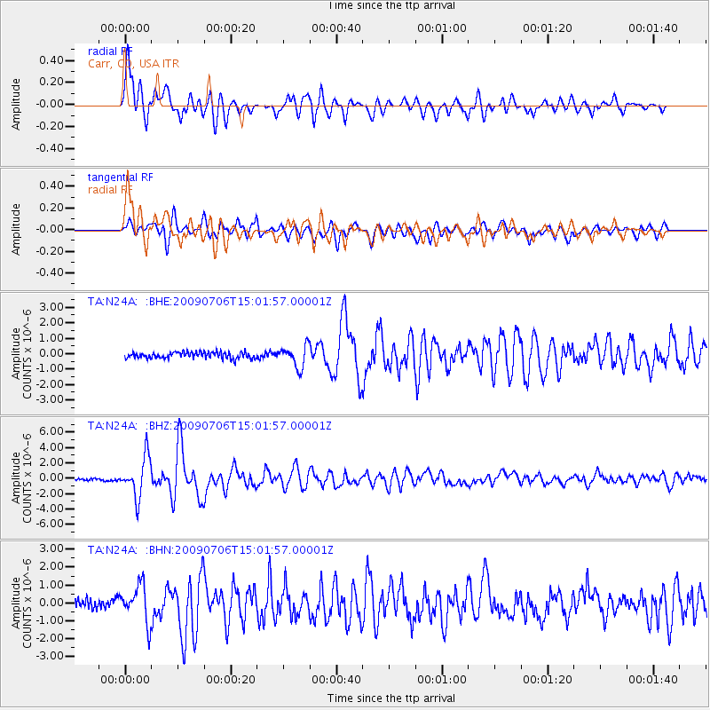
Earthquake location: Rat Islands, Aleutian Islands
Earthquake latitude/longitude: 50.4/177.0
Earthquake time(UTC): 2009/07/06 (187) 14:53:12 GMT
Earthquake Depth: 22 km
Earthquake Magnitude: 6.0 MB, 5.8 MS, 6.1 MW, 6.0 MW
Earthquake Catalog/Contributor: WHDF/NEIC
Network: TA USArray Transportable Network (new EarthScope stations)
Station: N24A Carr, CO, USA
Lat/Lon: 40.83 N/104.88 W
Elevation: 1695 m
Distance: 53.1 deg
Az: 68.239 deg
Baz: 308.495 deg
Ray Param: 0.06630149
Estimated Moho Depth: 17.25 km
Estimated Crust Vp/Vs: 2.01
Assumed Crust Vp: 6.306 km/s
Estimated Crust Vs: 3.145 km/s
Estimated Crust Poisson's Ratio: 0.33
Radial Match: 87.46972 %
Radial Bump: 400
Transverse Match: 77.15365 %
Transverse Bump: 400
SOD ConfigId: 2648
Insert Time: 2010-03-06 00:27:42.395 +0000
GWidth: 2.5
Max Bumps: 400
Tol: 0.001

Signal To Noise

ChannelStoNSTALTA
TA:N24A: :BHZ:20090706T15:01:57.00001Z17.2193682.6297948E-61.5272308E-7
TA:N24A: :BHN:20090706T15:01:57.00001Z4.51684671.0530714E-62.3314306E-7
TA:N24A: :BHE:20090706T15:01:57.00001Z3.5552947.0692784E-71.9883808E-7
Arrivals
Ps2.9 SECOND
PpPs7.8 SECOND
PsPs/PpSs11 SECOND