You are here: Home > Network List > TA - USArray Transportable Network (new EarthScope stations) Stations List
> Station N24A Carr, CO, USA > Earthquake Result Viewer
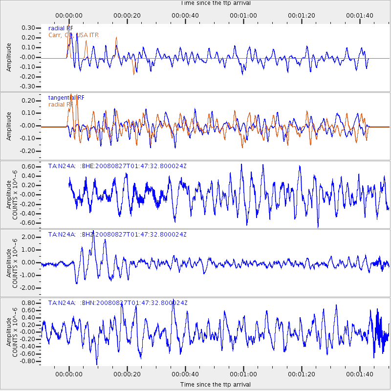
N24A Carr, CO, USA - Earthquake Result Viewer
*The percent match for this event was below the threshold and hence no stack was calculated.
| Earthquake location: |
Lake Baykal Region, Russia |
| Earthquake latitude/longitude: |
51.6/104.2 |
| Earthquake time(UTC): |
2008/08/27 (240) 01:35:32 GMT |
| Earthquake Depth: |
16 km |
| Earthquake Magnitude: |
5.8 MB, 6.2 MS, 6.2 MW, 6.2 MW |
| Earthquake Catalog/Contributor: |
WHDF/NEIC |
|
| Network: |
TA USArray Transportable Network (new EarthScope stations) |
| Station: |
N24A Carr, CO, USA |
| Lat/Lon: |
40.83 N/104.88 W |
| Elevation: |
1695 m |
|
| Distance: |
84.5 deg |
| Az: |
21.719 deg |
| Baz: |
342.296 deg |
| Ray Param: |
$rayparam |
*The percent match for this event was below the threshold and hence was not used in the summary stack. |
|
| Radial Match: |
71.26657 % |
| Radial Bump: |
400 |
| Transverse Match: |
72.840065 % |
| Transverse Bump: |
400 |
| SOD ConfigId: |
2504 |
| Insert Time: |
2010-03-06 00:27:59.217 +0000 |
| GWidth: |
2.5 |
| Max Bumps: |
400 |
| Tol: |
0.001 |
|
Signal To Noise
| Channel | StoN | STA | LTA |
| TA:N24A: :BHZ:20080827T01:47:32.800024Z | 7.0901036 | 7.1812696E-7 | 1.0128582E-7 |
| TA:N24A: :BHN:20080827T01:47:32.800024Z | 1.233984 | 2.5066373E-7 | 2.0313371E-7 |
| TA:N24A: :BHE:20080827T01:47:32.800024Z | 0.81993073 | 1.5812432E-7 | 1.9285082E-7 |
| Arrivals |
| Ps | |
| PpPs | |
| PsPs/PpSs | |


