You are here: Home > Network List > TA - USArray Transportable Network (new EarthScope stations) Stations List
> Station N24A Carr, CO, USA > Earthquake Result Viewer
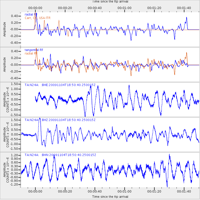
N24A Carr, CO, USA - Earthquake Result Viewer
*The percent match for this event was below the threshold and hence no stack was calculated.
| Earthquake location: |
Azores Islands Region |
| Earthquake latitude/longitude: |
36.2/-33.9 |
| Earthquake time(UTC): |
2009/11/04 (308) 18:41:44 GMT |
| Earthquake Depth: |
10 km |
| Earthquake Magnitude: |
5.7 MB, 5.6 MS, 5.9 MW, 5.8 MW |
| Earthquake Catalog/Contributor: |
WHDF/NEIC |
|
| Network: |
TA USArray Transportable Network (new EarthScope stations) |
| Station: |
N24A Carr, CO, USA |
| Lat/Lon: |
40.83 N/104.88 W |
| Elevation: |
1695 m |
|
| Distance: |
54.4 deg |
| Az: |
298.031 deg |
| Baz: |
70.287 deg |
| Ray Param: |
$rayparam |
*The percent match for this event was below the threshold and hence was not used in the summary stack. |
|
| Radial Match: |
52.981487 % |
| Radial Bump: |
400 |
| Transverse Match: |
63.13774 % |
| Transverse Bump: |
400 |
| SOD ConfigId: |
2622 |
| Insert Time: |
2010-03-06 00:28:53.389 +0000 |
| GWidth: |
2.5 |
| Max Bumps: |
400 |
| Tol: |
0.001 |
|
Signal To Noise
| Channel | StoN | STA | LTA |
| TA:N24A: :BHZ:20091104T18:50:40.250015Z | 5.3348317 | 9.0007757E-7 | 1.6871715E-7 |
| TA:N24A: :BHN:20091104T18:50:40.250015Z | 1.7516458 | 4.5288485E-7 | 2.585482E-7 |
| TA:N24A: :BHE:20091104T18:50:40.250015Z | 2.3489115 | 6.5769603E-7 | 2.8000036E-7 |
| Arrivals |
| Ps | |
| PpPs | |
| PsPs/PpSs | |


