You are here: Home > Network List > TA - USArray Transportable Network (new EarthScope stations) Stations List
> Station L15K Ungalak Mountain, AK, USA > Earthquake Result Viewer
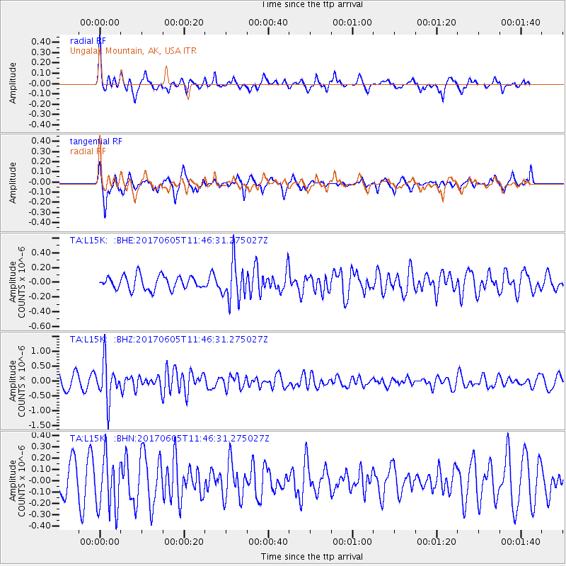
L15K Ungalak Mountain, AK, USA - Earthquake Result Viewer
*The percent match for this event was below the threshold and hence no stack was calculated.
| Earthquake location: |
Peru-Ecuador Border Region |
| Earthquake latitude/longitude: |
-4.1/-80.4 |
| Earthquake time(UTC): |
2017/06/05 (156) 11:34:11 GMT |
| Earthquake Depth: |
51 km |
| Earthquake Magnitude: |
5.6 Mww |
| Earthquake Catalog/Contributor: |
NEIC PDE/us |
|
| Network: |
TA USArray Transportable Network (new EarthScope stations) |
| Station: |
L15K Ungalak Mountain, AK, USA |
| Lat/Lon: |
61.68 N/161.49 W |
| Elevation: |
219 m |
|
| Distance: |
89.4 deg |
| Az: |
331.888 deg |
| Baz: |
99.759 deg |
| Ray Param: |
$rayparam |
*The percent match for this event was below the threshold and hence was not used in the summary stack. |
|
| Radial Match: |
66.242714 % |
| Radial Bump: |
400 |
| Transverse Match: |
68.71219 % |
| Transverse Bump: |
400 |
| SOD ConfigId: |
13570011 |
| Insert Time: |
2019-04-28 03:46:24.756 +0000 |
| GWidth: |
2.5 |
| Max Bumps: |
400 |
| Tol: |
0.001 |
|
Signal To Noise
| Channel | StoN | STA | LTA |
| TA:L15K: :BHZ:20170605T11:46:31.275027Z | 3.3670437 | 6.458598E-7 | 1.9181806E-7 |
| TA:L15K: :BHN:20170605T11:46:31.275027Z | 2.292204 | 2.3996066E-7 | 1.0468556E-7 |
| TA:L15K: :BHE:20170605T11:46:31.275027Z | 2.839544 | 2.6062673E-7 | 9.178471E-8 |
| Arrivals |
| Ps | |
| PpPs | |
| PsPs/PpSs | |


