You are here: Home > Network List > TA - USArray Transportable Network (new EarthScope stations) Stations List
> Station O17K Koliganek, Bristol Bay, AK, USA > Earthquake Result Viewer
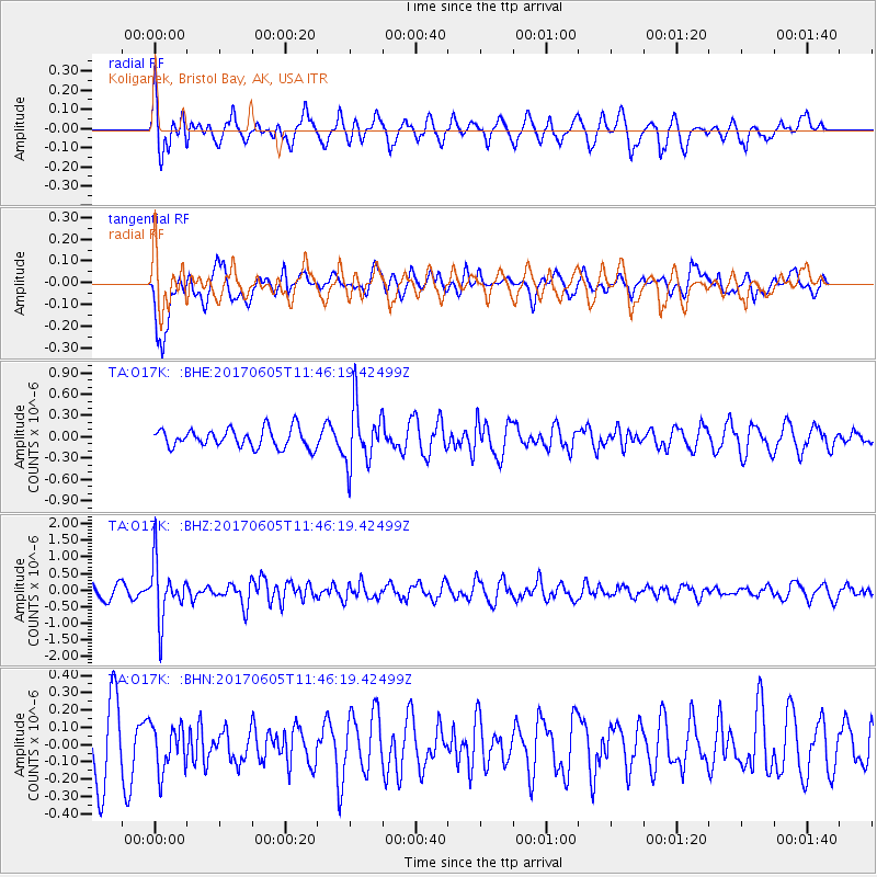
O17K Koliganek, Bristol Bay, AK, USA - Earthquake Result Viewer
*The percent match for this event was below the threshold and hence no stack was calculated.
| Earthquake location: |
Peru-Ecuador Border Region |
| Earthquake latitude/longitude: |
-4.1/-80.4 |
| Earthquake time(UTC): |
2017/06/05 (156) 11:34:11 GMT |
| Earthquake Depth: |
51 km |
| Earthquake Magnitude: |
5.6 Mww |
| Earthquake Catalog/Contributor: |
NEIC PDE/us |
|
| Network: |
TA USArray Transportable Network (new EarthScope stations) |
| Station: |
O17K Koliganek, Bristol Bay, AK, USA |
| Lat/Lon: |
59.77 N/157.09 W |
| Elevation: |
156 m |
|
| Distance: |
86.9 deg |
| Az: |
330.453 deg |
| Baz: |
103.538 deg |
| Ray Param: |
$rayparam |
*The percent match for this event was below the threshold and hence was not used in the summary stack. |
|
| Radial Match: |
60.948395 % |
| Radial Bump: |
400 |
| Transverse Match: |
61.896194 % |
| Transverse Bump: |
400 |
| SOD ConfigId: |
13570011 |
| Insert Time: |
2019-04-28 03:46:57.584 +0000 |
| GWidth: |
2.5 |
| Max Bumps: |
400 |
| Tol: |
0.001 |
|
Signal To Noise
| Channel | StoN | STA | LTA |
| TA:O17K: :BHZ:20170605T11:46:19.42499Z | 4.1360145 | 8.398703E-7 | 2.030627E-7 |
| TA:O17K: :BHN:20170605T11:46:19.42499Z | 0.71498936 | 1.3128731E-7 | 1.8362135E-7 |
| TA:O17K: :BHE:20170605T11:46:19.42499Z | 3.1395814 | 4.1736564E-7 | 1.3293672E-7 |
| Arrivals |
| Ps | |
| PpPs | |
| PsPs/PpSs | |


