
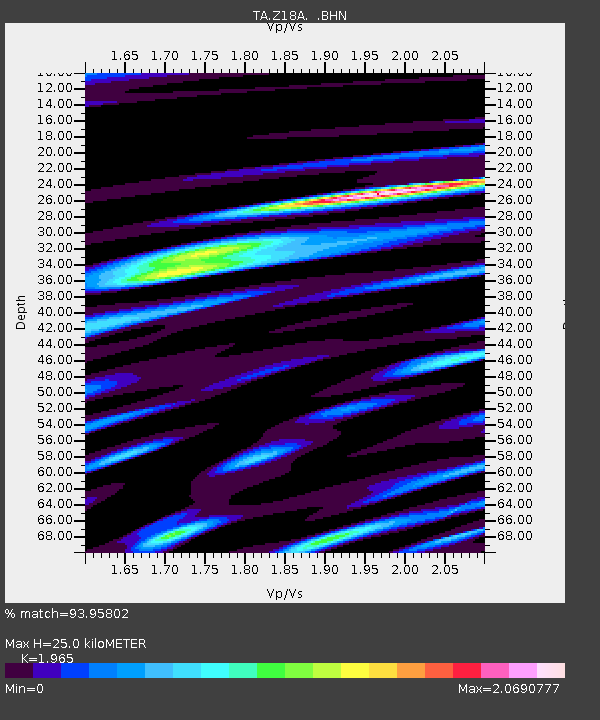
Z18A Geronimo, AZ, USA - Earthquake Result Viewer
| ||||||||||||||||||
| ||||||||||||||||||
| ||||||||||||||||||
|
Signal To Noise
| Channel | StoN | STA | LTA |
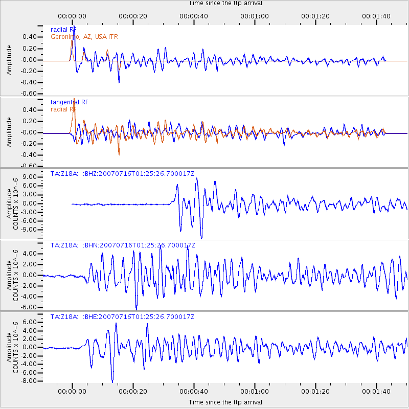
| TA:Z18A: :BHN:20070716T01:25:26.700017Z | 2.6529894 | 3.371189E-7 | 1.2707133E-7 |
| TA:Z18A: :BHE:20070716T01:25:26.700017Z | 5.534158 | 5.1101006E-7 | 9.233746E-8 |
| TA:Z18A: :BHZ:20070716T01:25:26.700017Z | 22.09099 | 2.26523E-6 | 1.025409E-7 |
| Arrivals | |
| Ps | 3.9 SECOND |
| PpPs | 12 SECOND |
| PsPs/PpSs | 15 SECOND |

