You are here: Home > Network List > UW - Pacific Northwest Regional Seismic Network Stations List
> Station LEBA Lebam, WA, USA > Earthquake Result Viewer
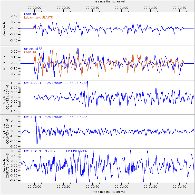
LEBA Lebam, WA, USA - Earthquake Result Viewer
*The percent match for this event was below the threshold and hence no stack was calculated.
| Earthquake location: |
Peru-Ecuador Border Region |
| Earthquake latitude/longitude: |
-4.1/-80.4 |
| Earthquake time(UTC): |
2017/06/05 (156) 11:34:11 GMT |
| Earthquake Depth: |
51 km |
| Earthquake Magnitude: |
5.6 Mww |
| Earthquake Catalog/Contributor: |
NEIC PDE/us |
|
| Network: |
UW Pacific Northwest Regional Seismic Network |
| Station: |
LEBA Lebam, WA, USA |
| Lat/Lon: |
46.55 N/123.56 W |
| Elevation: |
73 m |
|
| Distance: |
63.2 deg |
| Az: |
328.059 deg |
| Baz: |
130.131 deg |
| Ray Param: |
$rayparam |
*The percent match for this event was below the threshold and hence was not used in the summary stack. |
|
| Radial Match: |
74.43786 % |
| Radial Bump: |
400 |
| Transverse Match: |
63.32257 % |
| Transverse Bump: |
400 |
| SOD ConfigId: |
13570011 |
| Insert Time: |
2019-04-28 03:48:21.783 +0000 |
| GWidth: |
2.5 |
| Max Bumps: |
400 |
| Tol: |
0.001 |
|
Signal To Noise
| Channel | StoN | STA | LTA |
| UW:LEBA: :HHZ:20170605T11:44:03.698Z | 6.6425166 | 1.3572469E-6 | 2.0432722E-7 |
| UW:LEBA: :HHN:20170605T11:44:03.698Z | 1.1489246 | 2.5838324E-7 | 2.248914E-7 |
| UW:LEBA: :HHE:20170605T11:44:03.698Z | 2.2837133 | 4.1078889E-7 | 1.7987762E-7 |
| Arrivals |
| Ps | |
| PpPs | |
| PsPs/PpSs | |


