You are here: Home > Network List > TA - USArray Transportable Network (new EarthScope stations) Stations List
> Station Z18A Geronimo, AZ, USA > Earthquake Result Viewer
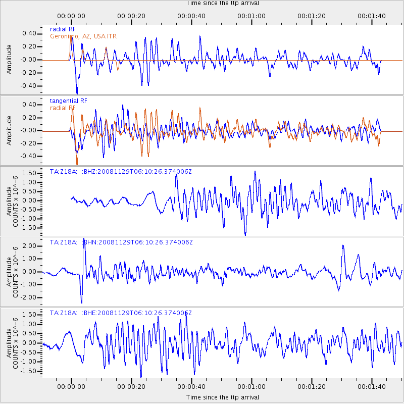
Z18A Geronimo, AZ, USA - Earthquake Result Viewer
*The percent match for this event was below the threshold and hence no stack was calculated.
| Earthquake location: |
Fiji Islands Region |
| Earthquake latitude/longitude: |
-18.7/-177.7 |
| Earthquake time(UTC): |
2008/11/29 (334) 05:59:16 GMT |
| Earthquake Depth: |
386 km |
| Earthquake Magnitude: |
5.7 MB, 6.0 MW, 5.9 MW |
| Earthquake Catalog/Contributor: |
WHDF/NEIC |
|
| Network: |
TA USArray Transportable Network (new EarthScope stations) |
| Station: |
Z18A Geronimo, AZ, USA |
| Lat/Lon: |
33.09 N/110.04 W |
| Elevation: |
812 m |
|
| Distance: |
82.6 deg |
| Az: |
51.553 deg |
| Baz: |
242.157 deg |
| Ray Param: |
$rayparam |
*The percent match for this event was below the threshold and hence was not used in the summary stack. |
|
| Radial Match: |
68.20424 % |
| Radial Bump: |
400 |
| Transverse Match: |
57.215916 % |
| Transverse Bump: |
400 |
| SOD ConfigId: |
2658 |
| Insert Time: |
2010-03-06 00:32:24.956 +0000 |
| GWidth: |
2.5 |
| Max Bumps: |
400 |
| Tol: |
0.001 |
|
Signal To Noise
| Channel | StoN | STA | LTA |
| TA:Z18A: :BHN:20081129T06:10:26.374006Z | 6.862765 | 1.0997569E-6 | 1.6024984E-7 |
| TA:Z18A: :BHE:20081129T06:10:26.374006Z | 1.8330028 | 5.7132587E-7 | 3.1168847E-7 |
| TA:Z18A: :BHZ:20081129T06:10:26.374006Z | 3.2888706 | 4.5856456E-7 | 1.3942919E-7 |
| Arrivals |
| Ps | |
| PpPs | |
| PsPs/PpSs | |


