You are here: Home > Network List > TA - USArray Transportable Network (new EarthScope stations) Stations List
> Station Z18A Geronimo, AZ, USA > Earthquake Result Viewer
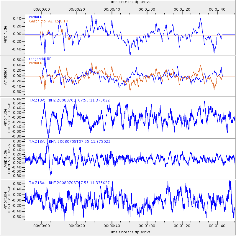
Z18A Geronimo, AZ, USA - Earthquake Result Viewer
*The percent match for this event was below the threshold and hence no stack was calculated.
| Earthquake location: |
Ryukyu Islands, Japan |
| Earthquake latitude/longitude: |
27.5/128.3 |
| Earthquake time(UTC): |
2008/07/08 (190) 07:42:10 GMT |
| Earthquake Depth: |
43 km |
| Earthquake Magnitude: |
6.0 MB, 5.5 MS, 6.0 MW, 6.0 MW |
| Earthquake Catalog/Contributor: |
WHDF/NEIC |
|
| Network: |
TA USArray Transportable Network (new EarthScope stations) |
| Station: |
Z18A Geronimo, AZ, USA |
| Lat/Lon: |
33.09 N/110.04 W |
| Elevation: |
812 m |
|
| Distance: |
98.1 deg |
| Az: |
46.224 deg |
| Baz: |
310.204 deg |
| Ray Param: |
$rayparam |
*The percent match for this event was below the threshold and hence was not used in the summary stack. |
|
| Radial Match: |
58.188103 % |
| Radial Bump: |
400 |
| Transverse Match: |
65.687805 % |
| Transverse Bump: |
400 |
| SOD ConfigId: |
2504 |
| Insert Time: |
2010-03-06 00:32:53.324 +0000 |
| GWidth: |
2.5 |
| Max Bumps: |
400 |
| Tol: |
0.001 |
|
Signal To Noise
| Channel | StoN | STA | LTA |
| TA:Z18A: :BHN:20080708T07:55:11.37502Z | 2.5944664 | 3.6926014E-7 | 1.4232604E-7 |
| TA:Z18A: :BHE:20080708T07:55:11.37502Z | 1.2393279 | 1.9222485E-7 | 1.551041E-7 |
| TA:Z18A: :BHZ:20080708T07:55:11.37502Z | 0.6693808 | 2.1739513E-7 | 3.2477047E-7 |
| Arrivals |
| Ps | |
| PpPs | |
| PsPs/PpSs | |


