You are here: Home > Network List > TA - USArray Transportable Network (new EarthScope stations) Stations List
> Station D25K Kavik River, AK, USA > Earthquake Result Viewer
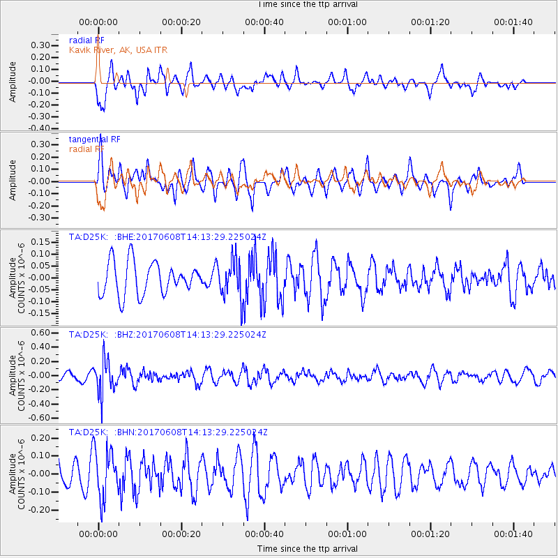
D25K Kavik River, AK, USA - Earthquake Result Viewer
*The percent match for this event was below the threshold and hence no stack was calculated.
| Earthquake location: |
Northern Peru |
| Earthquake latitude/longitude: |
-8.0/-75.9 |
| Earthquake time(UTC): |
2017/06/08 (159) 14:01:09 GMT |
| Earthquake Depth: |
108 km |
| Earthquake Magnitude: |
5.2 Mww |
| Earthquake Catalog/Contributor: |
NEIC PDE/us |
|
| Network: |
TA USArray Transportable Network (new EarthScope stations) |
| Station: |
D25K Kavik River, AK, USA |
| Lat/Lon: |
69.32 N/146.38 W |
| Elevation: |
770 m |
|
| Distance: |
90.7 deg |
| Az: |
340.435 deg |
| Baz: |
110.971 deg |
| Ray Param: |
$rayparam |
*The percent match for this event was below the threshold and hence was not used in the summary stack. |
|
| Radial Match: |
61.352844 % |
| Radial Bump: |
400 |
| Transverse Match: |
43.15518 % |
| Transverse Bump: |
400 |
| SOD ConfigId: |
13570011 |
| Insert Time: |
2019-04-28 04:02:42.570 +0000 |
| GWidth: |
2.5 |
| Max Bumps: |
400 |
| Tol: |
0.001 |
|
Signal To Noise
| Channel | StoN | STA | LTA |
| TA:D25K: :BHZ:20170608T14:13:29.225024Z | 3.9441776 | 2.2824022E-7 | 5.786763E-8 |
| TA:D25K: :BHN:20170608T14:13:29.225024Z | 2.5925 | 1.3055804E-7 | 5.0359898E-8 |
| TA:D25K: :BHE:20170608T14:13:29.225024Z | 1.1820632 | 8.149077E-8 | 6.893943E-8 |
| Arrivals |
| Ps | |
| PpPs | |
| PsPs/PpSs | |


