You are here: Home > Network List > TA - USArray Transportable Network (new EarthScope stations) Stations List
> Station J26L Joseph Creek, AK, USA > Earthquake Result Viewer
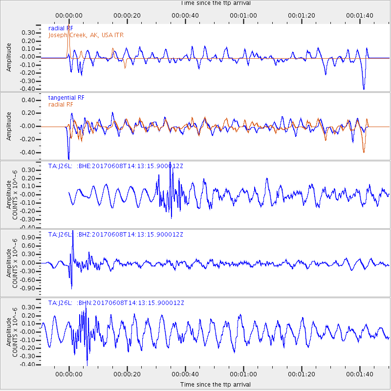
J26L Joseph Creek, AK, USA - Earthquake Result Viewer
*The percent match for this event was below the threshold and hence no stack was calculated.
| Earthquake location: |
Northern Peru |
| Earthquake latitude/longitude: |
-8.0/-75.9 |
| Earthquake time(UTC): |
2017/06/08 (159) 14:01:09 GMT |
| Earthquake Depth: |
108 km |
| Earthquake Magnitude: |
5.2 Mww |
| Earthquake Catalog/Contributor: |
NEIC PDE/us |
|
| Network: |
TA USArray Transportable Network (new EarthScope stations) |
| Station: |
J26L Joseph Creek, AK, USA |
| Lat/Lon: |
64.50 N/143.56 W |
| Elevation: |
1144 m |
|
| Distance: |
87.8 deg |
| Az: |
336.373 deg |
| Baz: |
113.504 deg |
| Ray Param: |
$rayparam |
*The percent match for this event was below the threshold and hence was not used in the summary stack. |
|
| Radial Match: |
53.789425 % |
| Radial Bump: |
400 |
| Transverse Match: |
59.96748 % |
| Transverse Bump: |
400 |
| SOD ConfigId: |
13570011 |
| Insert Time: |
2019-04-28 04:02:56.642 +0000 |
| GWidth: |
2.5 |
| Max Bumps: |
400 |
| Tol: |
0.001 |
|
Signal To Noise
| Channel | StoN | STA | LTA |
| TA:J26L: :BHZ:20170608T14:13:15.900012Z | 4.108509 | 3.147956E-7 | 7.6620395E-8 |
| TA:J26L: :BHN:20170608T14:13:15.900012Z | 1.5542067 | 1.2275336E-7 | 7.898136E-8 |
| TA:J26L: :BHE:20170608T14:13:15.900012Z | 1.686885 | 1.263594E-7 | 7.490694E-8 |
| Arrivals |
| Ps | |
| PpPs | |
| PsPs/PpSs | |


