You are here: Home > Network List > TA - USArray Transportable Network (new EarthScope stations) Stations List
> Station R31K City Hall, Gustavus, AK, USA > Earthquake Result Viewer
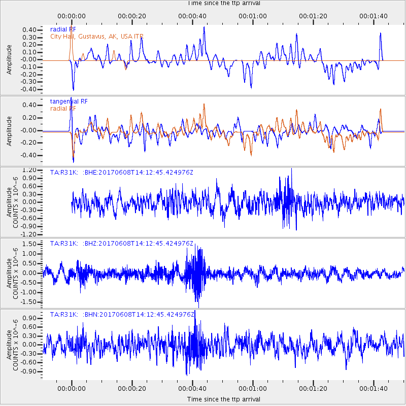
R31K City Hall, Gustavus, AK, USA - Earthquake Result Viewer
*The percent match for this event was below the threshold and hence no stack was calculated.
| Earthquake location: |
Northern Peru |
| Earthquake latitude/longitude: |
-8.0/-75.9 |
| Earthquake time(UTC): |
2017/06/08 (159) 14:01:09 GMT |
| Earthquake Depth: |
108 km |
| Earthquake Magnitude: |
5.2 Mww |
| Earthquake Catalog/Contributor: |
NEIC PDE/us |
|
| Network: |
TA USArray Transportable Network (new EarthScope stations) |
| Station: |
R31K City Hall, Gustavus, AK, USA |
| Lat/Lon: |
58.41 N/135.74 W |
| Elevation: |
15 m |
|
| Distance: |
81.7 deg |
| Az: |
332.608 deg |
| Baz: |
120.034 deg |
| Ray Param: |
$rayparam |
*The percent match for this event was below the threshold and hence was not used in the summary stack. |
|
| Radial Match: |
36.517517 % |
| Radial Bump: |
400 |
| Transverse Match: |
60.40131 % |
| Transverse Bump: |
400 |
| SOD ConfigId: |
13570011 |
| Insert Time: |
2019-04-28 04:03:18.198 +0000 |
| GWidth: |
2.5 |
| Max Bumps: |
400 |
| Tol: |
0.001 |
|
Signal To Noise
| Channel | StoN | STA | LTA |
| TA:R31K: :BHZ:20170608T14:12:45.424976Z | 1.7035315 | 3.1885298E-7 | 1.8717176E-7 |
| TA:R31K: :BHN:20170608T14:12:45.424976Z | 1.2400506 | 2.398469E-7 | 1.9341704E-7 |
| TA:R31K: :BHE:20170608T14:12:45.424976Z | 1.3210684 | 3.0406144E-7 | 2.3016328E-7 |
| Arrivals |
| Ps | |
| PpPs | |
| PsPs/PpSs | |


